


Embark on a journey curated by seasoned explorers William and Hui Cha Stanek, who have spent decades immersing themselves in the diverse landscapes of North America. These itineraries are more than just travel plans - they are thoughtfully crafted adventures designed to help you connect with the natural world, discover hidden gems, and create lasting memories.
National Parks Index | US Itineraries Index | American Roadtrips Index

Bring home a Bugville Critters book and watch as your child's love for reading and learning grows with every page. Hand-painted illustrations bring the heartwarming stories to life. Ask your librarian to add Bugville Critters to the library's digital collection today!
Discover William Stanek's Exclusive Art Collection
Explore and purchase the stunning art featured on this site. Own a piece of William Stanek's unique and captivating artwork today!
(September 16, 2024) Red Rocks: Capitol Reef and Bryce Canyon National Parks, A 2-Day Itinerary.
Personal Story: William's First Encounter with the Red Rocks of Utah
The first time I ventured into the red rock country of Utah, I was awestruck by the stark beauty and ancient landscapes that stretched as far as the eye could see. I remember driving along a remote road and catching my first glimpse of Capitol Reef's Waterpocket Fold – a massive geological wrinkle in the Earth's crust that seemed to defy time itself. The towering cliffs, narrow canyons, and twisted rock formations were unlike anything I had ever seen, and I knew right then that this was a place I had to explore.
A few days later, I found myself standing at the rim of Bryce Canyon, gazing out over a sea of orange and pink hoodoos – spindly rock spires that have been shaped by millions of years of erosion. The sight was both surreal and magical, as if I had stumbled into a giant natural amphitheater filled with stone sculptures. Each of these parks offered its own unique wonders, and together they created an unforgettable journey through the heart of Utah's canyon country. In this dual adventure, Hui Cha and I will guide you through the best of Capitol Reef and Bryce Canyon, sharing our favorite hikes, photography tips, and insider knowledge to help you make the most of your visit to these incredible national parks.
About Capitol Reef National Park
Capitol Reef National Park, located in south-central Utah, is a hidden gem known for its dramatic desert landscapes, including the Waterpocket Fold – a 100-mile long monocline that forms the park's backbone. The park's name comes from the white domes of Navajo sandstone that resemble the U.S. Capitol building and the rugged ridges and cliffs that early settlers likened to ocean reefs. Capitol Reef is a place of stunning contrasts, where lush orchards and historic pioneer sites coexist with towering cliffs, narrow slot canyons, and colorful rock formations. Whether you're hiking through the winding narrows of Capitol Gorge, exploring the petroglyphs left behind by the Fremont people, or simply soaking in the expansive views from a high desert mesa, Capitol Reef offers a unique and deeply immersive experience of Utah's wild beauty.
About Bryce Canyon National Park
Bryce Canyon National Park, located in southwestern Utah, is world-renowned for its otherworldly landscape of hoodoos – tall, thin spires of rock that have been sculpted by wind and water over millions of years. The park's main feature is Bryce Amphitheater, a vast, natural bowl filled with thousands of these colorful rock formations that seem to glow in the soft light of sunrise and sunset. Despite its name, Bryce Canyon isn't actually a canyon but a series of natural amphitheaters carved into the edge of the Paunsaugunt Plateau. The park's unique geology, combined with its clear, dark skies, makes it a haven for photographers, stargazers, and anyone who appreciates the surreal beauty of nature's artistry. From easy walks along the rim to challenging hikes down into the heart of the amphitheater, Bryce Canyon offers a variety of ways to explore and experience this stunning landscape.
Day 1: A Deep Dive into Capitol Reef National Park
Morning: Hiking the Grand Wash Trail
7:00 AM - Start at the Grand Wash Trailhead
Overview: Begin your adventure in Capitol Reef with a hike through the Grand Wash, a narrow, winding canyon that cuts through the heart of the Waterpocket Fold. The Grand Wash Trail is one of the park's most popular hikes, offering stunning views of towering cliffs, colorful rock layers, and narrow slot canyons. The hike is relatively easy, with a gradual incline and plenty of shade in the morning, making it a perfect way to start your day.
Tips from William: "The Grand Wash is a photographer's paradise, with its towering cliffs and narrow canyons creating dramatic contrasts of light and shadow. Bring a wide-angle lens to capture the scale of the canyon walls, and be prepared for some fantastic close-ups of the colorful rock layers. The early morning light is soft and warm, making it an ideal time for photography."
Insights from Hui Cha: "The Grand Wash Trail is about 4.4 miles round trip, with minimal elevation gain. The trail follows the dry wash through the canyon, with plenty of opportunities to explore side canyons and alcoves. Wear sturdy shoes with good traction – the trail can be sandy and rocky in places. And don't forget to bring plenty of water and sunscreen – the canyon can get hot later in the day."
How to Access the Grand Wash Trail
Location: The Grand Wash Trailhead is located along the Scenic Drive in Capitol Reef National Park, about 5 miles from the visitor center.
Directions: From the Capitol Reef Visitor Center, head south on the Scenic Drive for about 5 miles until you reach the signed trailhead for Grand Wash. There is parking available at the trailhead, and the trail begins at the end of the parking area.
Trail Details: The Grand Wash Trail is a 4.4-mile round trip hike with minimal elevation gain. The trail follows the dry wash through a narrow canyon, with towering cliffs on either side. The canyon walls are full of colorful rock layers and interesting geological features, making this a visually stunning hike.
Photography Techniques:
-
Canyon Compositions: Use a wide-angle lens to capture the scale of the canyon walls and the narrowness of the wash. Look for opportunities to include foreground elements, like rocks or plants, to add depth to your images.
-
Close-Ups of Rock Layers: The colorful rock layers in the Grand Wash are perfect for close-up photography. Use a telephoto lens to isolate patterns and textures in the rock, and experiment with different angles to highlight the contrast between the colors.
-
Light and Shadow Play: The narrow canyon creates dramatic contrasts of light and shadow, especially in the early morning or late afternoon. Use a tripod to capture the interplay of light and dark, and experiment with different exposures to capture the full range of tones in the scene.
Alternative Activity:
If you prefer a shorter hike, consider exploring the nearby Capitol Gorge Trail. This 2-mile round trip hike takes you through another narrow canyon with similar stunning views. The trail is relatively flat and easy, with plenty of opportunities to explore petroglyphs, pioneer inscriptions, and a small natural water pocket known as the "tanks."
Mid-Morning: Exploring the Historic Fruita District
10:00 AM - Visit the Fruita District
Overview: After your hike, head to the Fruita District, the historic heart of Capitol Reef National Park. This lush, green valley was settled by Mormon pioneers in the late 19th century, and their legacy lives on in the well-preserved orchards, farm buildings, and the iconic Gifford Homestead. The Fruita District offers a fascinating glimpse into the history and culture of the area, with opportunities to pick fresh fruit, explore the historic sites, and enjoy a leisurely picnic by the Fremont River.
Tips from William: "The Fruita District is a beautiful and peaceful place to explore, with plenty of opportunities for photography. The orchards are especially photogenic in the spring when the trees are in bloom, and in the fall when the fruit is ripe. Bring a telephoto lens to capture close-ups of the fruit and flowers, and a wide-angle lens for landscape shots of the orchards and historic buildings."
Insights from Hui Cha: "The Gifford Homestead is a must-visit, especially if you're a fan of homemade pies and preserves. The small store inside the homestead sells delicious baked goods made from the fruit grown in the orchards, as well as unique handmade crafts. Take your time to explore the area, and be sure to visit the nearby Fruita Schoolhouse and the old blacksmith shop."
How to Access the Fruita District
Location: The Fruita District is located along the Scenic Drive in Capitol Reef National Park, just a few miles from the visitor center.
Directions: From the Capitol Reef Visitor Center, follow the Scenic Drive south for about 3 miles to reach the Fruita District. The area is well-marked, with parking available near the Gifford Homestead and other historic sites.
Exploration Details: The Fruita District is a well-preserved historic area within Capitol Reef National Park. The orchards are open to visitors for fruit picking during the harvest season (typically June through October), and the historic buildings, including the Gifford Homestead, Fruita Schoolhouse, and blacksmith shop, offer a glimpse into the pioneer life of the early settlers.
Photography Techniques:
-
Orchard Landscapes: Use a wide-angle lens to capture the beauty of the orchards, especially in the early morning or late afternoon light. Look for compositions that include the fruit trees, historic buildings, and the surrounding cliffs.
-
Close-Ups of Fruit and Flowers: The fruit and flowers in the orchards are perfect for macro photography. Use a telephoto or macro lens to capture the intricate details of the blossoms and the vibrant colors of the ripe fruit.
-
Historic Architecture: The Gifford Homestead and other historic buildings in the Fruita District offer great opportunities for architectural photography. Use a wide-angle lens to capture the entire structure, and experiment with different angles and perspectives to highlight the unique features of the buildings.
Alternative Activity:
If you're not interested in exploring the historic sites, consider taking a short hike to the Fremont River Waterfall. This easy 1.5-mile round trip hike takes you to a small but beautiful waterfall along the Fremont River, offering a peaceful spot to relax and enjoy the natural beauty of the park.
Afternoon: Scenic Drive and Sunset at Panorama Point
1:00 PM - Drive the Scenic Drive
Overview: After exploring the Fruita District, take a leisurely drive along Capitol Reef's Scenic Drive, a 10-mile road that winds through some of the most spectacular landscapes in the park. The drive takes you past colorful cliffs, towering monoliths, and expansive desert vistas, with plenty of opportunities to stop and take in the views. After your drive, head to Panorama Point for a breathtaking sunset over the red rock formations.
Tips from William: "The Scenic Drive is one of the best ways to experience the beauty of Capitol Reef, especially if you're short on time or prefer to explore from the comfort of your car. The road is paved and easy to navigate, with numerous pull-offs where you can stop and take photos. Be sure to bring a wide-angle lens to capture the expansive views, and a polarizing filter to enhance the colors and reduce glare."
Insights from Hui Cha: "The drive is peaceful and relaxing, with plenty of opportunities to stop and explore. One of my favorite spots is the Goosenecks Overlook, where you can see the winding bends of Sulphur Creek far below. After your drive, head to Panorama Point for sunset – the views from here are simply stunning, with the sun casting a warm glow over the red rock formations."
How to Access the Scenic Drive and Panorama Point
Location: The Scenic Drive begins just south of the Fruita District in Capitol Reef National Park, and Panorama Point is located along Highway 24, just a few miles west of the visitor center.
Directions: From the Fruita District, head south on the Scenic Drive for about 10 miles, then return to Highway 24 and head west for about 3 miles to reach Panorama Point. Both the Scenic Drive and Panorama Point are well-marked, with parking available at various pull-offs and viewpoints along the way.
Drive Details: The Scenic Drive in Capitol Reef is a 10-mile paved road that takes you through some of the park's most scenic landscapes. The road is suitable for all vehicles, and there are several pull-offs where you can park and explore on foot. Panorama Point is a popular spot for sunset photography, offering panoramic views of the surrounding desert and red rock formations.
Photography Techniques:
-
Desert Landscapes: Use a wide-angle lens to capture the expansive desert landscapes along the Scenic Drive. Look for compositions that include the road, rock formations, and sky, and consider using a polarizing filter to enhance the colors and contrast.
-
Sunset at Panorama Point: Panorama Point is a perfect spot for sunset photography. Use a tripod and a graduated neutral density filter to balance the exposure between the bright sky and the darker landscape, and experiment with different compositions to capture the changing light and shadows.
-
Geological Features: The rock formations along the Scenic Drive are full of interesting textures and patterns. Use a telephoto lens to isolate details in the rock, and experiment with different angles to highlight the contrast between the colors and shapes.
Alternative Activity:
If you prefer a more active afternoon, consider hiking the Chimney Rock Trail. This 3.5-mile loop takes you to the top of a prominent rock formation with stunning views of the surrounding landscape. The hike is moderately challenging, with a steep ascent, but the views from the top are well worth the effort.
Evening: Stargazing at Capitol Reef
8:00 PM - Stargazing at Capitol Reef National Park
Overview: End your day with a stargazing session at Capitol Reef, one of the best places in the country for viewing the night sky. The park's remote location and low light pollution make it an ideal spot for stargazing, with clear, dark skies that reveal the Milky Way and countless stars. The Gifford Homestead area is a popular spot for stargazing, offering unobstructed views of the night sky.
Tips from William: "Capitol Reef is a fantastic place to experience the night sky. The lack of light pollution and the high elevation make for excellent stargazing conditions, with clear views of the Milky Way and other celestial objects. Bring a telescope or binoculars, and use a tripod for long exposures if you're photographing the stars."
Insights from Hui Cha: "The night sky at Capitol Reef is something truly special. The stars seem to stretch on forever, and the silence of the desert creates a peaceful and contemplative atmosphere. Bring a blanket and a warm drink, and take your time soaking in the beauty of the universe."
How to Access the Stargazing Area
Location: The Gifford Homestead area is located in the Fruita District, just off the Scenic Drive in Capitol Reef National Park.
Directions: From Panorama Point, return to Highway 24 and head east to the Fruita District. Follow signs for the Gifford Homestead, where you'll find parking and access to the stargazing area.
Stargazing Details: The Gifford Homestead area offers unobstructed views of the night sky, with little light pollution and clear skies. The high elevation and remote location of Capitol Reef make it one of the best places in the country for stargazing.
Photography Techniques:
-
Star Trails: Use a wide-angle lens and a tripod to capture long-exposure shots of star trails. Experiment with different shutter speeds to create dramatic patterns in the sky.
-
Milky Way Photography: The Milky Way is often visible from Capitol Reef, especially in the summer months. Use a fast lens (f/2.8 or faster) and a high ISO setting to capture the detail of the Milky Way, and include the surrounding landscape in your composition for added context.
-
Nightscapes: The high elevation and clear air at Capitol Reef make for excellent nightscape photography. Use a tripod and a remote shutter release to capture sharp, detailed images of the stars and the surrounding landscape.
Alternative Activity:
If you prefer a more structured stargazing experience, consider attending one of the park's ranger-led astronomy programs. These programs are offered during the summer months and provide a guided tour of the night sky, with telescopes and other equipment available for public use. It's a great way to learn more about the stars and the cosmos while enjoying the beauty of Capitol Reef.
Day 2: The Surreal Landscapes of Bryce Canyon National Park
Morning: Sunrise at Bryce Point
6:00 AM - Start at Bryce Point
Overview: Begin your second day with a sunrise at Bryce Point, one of the most iconic viewpoints in Bryce Canyon National Park. Bryce Point offers sweeping views of the Bryce Amphitheater and its countless hoodoos, which seem to glow in the soft light of dawn. The sight of the sun rising over this surreal landscape is one of the most memorable experiences in the park.
Tips from William: "Sunrise at Bryce Point is a truly magical experience. The hoodoos seem to come alive in the early morning light, with their colors changing from deep reds and oranges to soft pinks and yellows. Bring a tripod and a wide-angle lens to capture the full scene, and be sure to arrive early to get a good spot – the viewpoint can get crowded."
Insights from Hui Cha: "The temperature can be quite chilly in the early morning, even in summer, so dress warmly and bring a thermos of hot coffee or tea. After sunrise, take some time to explore the nearby trails – the views are just as beautiful, and you'll have the trails mostly to yourself."
How to Access Bryce Point
Location: Bryce Point is located along the main park road in Bryce Canyon National Park, about 3 miles from the visitor center.
Directions: From the Bryce Canyon Visitor Center, head south on the main park road for about 3 miles until you reach the signed turnoff for Bryce Point. Follow the road to the parking area, where you'll find access to the viewpoint.
Exploration Details: Bryce Point is one of the most popular viewpoints in Bryce Canyon National Park, offering stunning panoramic views of the Bryce Amphitheater. The viewpoint is easily accessible by car, with parking available at the viewpoint. The best time to visit is at sunrise, when the hoodoos are bathed in soft, golden light.
Photography Techniques:
-
Sunrise Landscapes: Use a wide-angle lens to capture the expansive views of the Bryce Amphitheater at sunrise. A graduated neutral density filter can help balance the exposure between the bright sky and the darker landscape, and a tripod is essential for capturing sharp, detailed images.
-
Hoodoo Close-Ups: The hoodoos at Bryce Point are full of interesting textures and shapes. Use a telephoto lens to isolate details in the rock formations, and experiment with different angles to highlight the contrast between the colors and shapes.
-
Panoramic Views: The sweeping views from Bryce Point are perfect for panoramic photography. Use a tripod and a panoramic head to capture the full sweep of the landscape, including the hoodoos, cliffs, and sky.
Alternative Activity:
If you prefer a less crowded sunrise spot, consider heading to Inspiration Point instead. This viewpoint offers similar views of the Bryce Amphitheater, but with fewer people. The viewpoint is easily accessible by car, and the short walk to the upper viewpoint offers even better views.
Mid-Morning: Hiking the Navajo Loop and Queen's Garden Trail
9:00 AM - Hike the Navajo Loop and Queen's Garden Trail
Overview: After sunrise, take a hike down into the Bryce Amphitheater on the Navajo Loop and Queen's Garden Trail. This combination of trails is one of the most popular hikes in the park, offering close-up views of the hoodoos and other rock formations. The trail takes you through narrow switchbacks, past iconic formations like Thor's Hammer, and into a surreal landscape of spires, fins, and windows.
Tips from William: "The Navajo Loop and Queen's Garden Trail is a fantastic way to experience the unique geology of Bryce Canyon up close. The trail is well-maintained, but it can be steep and sandy in places, so wear sturdy shoes with good traction. Bring a wide-angle lens to capture the sweeping views of the hoodoos, and a telephoto lens for close-ups of the rock formations."
Insights from Hui Cha: "The trail is about 3 miles round trip, with a moderate elevation gain. The descent into the amphitheater is steep but manageable, and the views from the bottom are well worth the effort. The Queen's Garden section of the trail is especially beautiful, with its colorful rock formations and narrow passages. Take your time and enjoy the scenery – there are plenty of places to stop and take photos."
How to Access the Navajo Loop and Queen's Garden Trail
Location: The Navajo Loop and Queen's Garden Trailhead is located at Sunrise Point in Bryce Canyon National Park, about 1 mile from the visitor center.
Directions: From the Bryce Canyon Visitor Center, head south on the main park road for about 1 mile to the signed turnoff for Sunrise Point. Follow the road to the parking area, where you'll find access to the trailhead.
Trail Details: The Navajo Loop and Queen's Garden Trail is a 3-mile round trip hike with about 600 feet of elevation gain. The trail is well-maintained and takes you through some of the most iconic landscapes in Bryce Canyon, including narrow switchbacks, towering hoodoos, and colorful rock formations. The trail is moderately challenging, with steep descents and ascents, but the views are well worth the effort.
Photography Techniques:
-
Hoodoo Landscapes: Use a wide-angle lens to capture the unique rock formations along the Navajo Loop and Queen's Garden Trail. Look for compositions that include the trail, hoodoos, and sky, and consider using a polarizing filter to enhance the colors and contrast.
-
Thor's Hammer Close-Up: Thor's Hammer is one of the most iconic formations in Bryce Canyon. Use a telephoto lens to isolate the formation and capture the details of the rock, and experiment with different angles to highlight the contrast between the colors and shapes.
-
Sunrise Point Views: The views from Sunrise Point at the end of the trail are perfect for panoramic photography. Use a tripod and a panoramic head to capture the full sweep of the landscape, including the hoodoos, cliffs, and sky.
Alternative Activity:
If you prefer a less challenging hike, consider exploring the Rim Trail instead. This easy, flat trail follows the edge of the Bryce Amphitheater, offering stunning views of the hoodoos and the surrounding landscape. The trail is about 5.5 miles long, but you can choose to hike shorter sections depending on your time and energy.
Afternoon: Exploring Bryce Canyon's Scenic Drive
1:00 PM - Drive Bryce Canyon's Scenic Drive
Overview: After your hike, take a leisurely drive along Bryce Canyon's Scenic Drive, a 18-mile road that offers stunning views of the park's unique landscapes. The drive takes you past several viewpoints, including Natural Bridge, Agua Canyon, and Rainbow Point, each offering a different perspective on the park's geology. The drive is a great way to see the park from the comfort of your car, with plenty of opportunities to stop and take in the views.
Tips from William: "Bryce Canyon's Scenic Drive is one of the best ways to experience the park's diverse landscapes. The road is well-paved and easy to navigate, with numerous pull-offs where you can stop and take photos. Bring a wide-angle lens to capture the expansive views, and a polarizing filter to enhance the colors and reduce glare."
Insights from Hui Cha: "The drive is peaceful and relaxing, with plenty of places to stop and explore. One of my favorite spots is Natural Bridge, a stunning rock formation that spans a small canyon. After your drive, head to Rainbow Point for sunset – the views from here are simply stunning, with the sun casting a warm glow over the red rock formations."
How to Access Bryce Canyon's Scenic Drive
Location: Bryce Canyon's Scenic Drive begins at the park entrance and continues south for 18 miles to Rainbow Point.
Directions: From the Bryce Canyon Visitor Center, head south on the main park road for about 18 miles to reach Rainbow Point. The Scenic Drive is well-marked, with parking available at various pull-offs and viewpoints along the way.
Drive Details: Bryce Canyon's Scenic Drive is an 18-mile road that takes you through some of the park's most scenic landscapes. The road is paved and suitable for all vehicles, with several pull-offs where you can park and explore on foot. Rainbow Point is a popular spot for sunset photography, offering panoramic views of the surrounding desert and red rock formations.
Photography Techniques:
-
Desert Landscapes: Use a wide-angle lens to capture the expansive desert landscapes along Bryce Canyon's Scenic Drive. Look for compositions that include the road, rock formations, and sky, and consider using a polarizing filter to enhance the colors and contrast.
-
Natural Bridge Close-Up: Natural Bridge is one of the most iconic formations along the Scenic Drive. Use a telephoto lens to isolate the formation and capture the details of the rock, and experiment with different angles to highlight the contrast between the colors and shapes.
-
Sunset at Rainbow Point: Rainbow Point is a perfect spot for sunset photography. Use a tripod and a graduated neutral density filter to balance the exposure between the bright sky and the darker landscape, and experiment with different compositions to capture the changing light and shadows.
Alternative Activity:
If you prefer a more active afternoon, consider hiking the Peekaboo Loop Trail. This 5.5-mile loop takes you through the heart of the Bryce Amphitheater, offering close-up views of the hoodoos and other rock formations. The hike is moderately challenging, with steep descents and ascents, but the views are well worth the effort.
Evening: Stargazing at Bryce Canyon
8:00 PM - Stargazing at Bryce Canyon National Park
Overview: End your day with a stargazing session at Bryce Canyon, one of the best places in the country for viewing the night sky. The park's high elevation and remote location make it an ideal spot for stargazing, with clear, dark skies that reveal the Milky Way and countless stars. The Bryce Amphitheater is a popular spot for stargazing, offering unobstructed views of the night sky.
Tips from William: "Bryce Canyon is a fantastic place to experience the night sky. The lack of light pollution and the high elevation make for excellent stargazing conditions, with clear views of the Milky Way and other celestial objects. Bring a telescope or binoculars, and use a tripod for long exposures if you're photographing the stars."
Insights from Hui Cha: "The night sky at Bryce Canyon is something truly special. The stars seem to stretch on forever, and the silence of the desert creates a peaceful and contemplative atmosphere. Bring a blanket and a warm drink, and take your time soaking in the beauty of the universe."
How to Access the Stargazing Area
Location: The Bryce Amphitheater is located along the main park road in Bryce Canyon National Park, about 1 mile from the visitor center.
Directions: From Rainbow Point, return to the Bryce Amphitheater and follow signs for the stargazing area. The amphitheater is easily accessible by car, with parking available at the viewpoint.
Stargazing Details: The Bryce Amphitheater offers unobstructed views of the night sky, with little light pollution and clear skies. The high elevation and remote location of Bryce Canyon make it one of the best places in the country for stargazing.
Photography Techniques:
-
Star Trails: Use a wide-angle lens and a tripod to capture long-exposure shots of star trails. Experiment with different shutter speeds to create dramatic patterns in the sky.
-
Milky Way Photography: The Milky Way is often visible from Bryce Canyon, especially in the summer months. Use a fast lens (f/2.8 or faster) and a high ISO setting to capture the detail of the Milky Way, and include the surrounding landscape in your composition for added context.
-
Nightscapes: The high elevation and clear air at Bryce Canyon make for excellent nightscape photography. Use a tripod and a remote shutter release to capture sharp, detailed images of the stars and the surrounding landscape.
Alternative Activity:
If you prefer a more structured stargazing experience, consider attending one of the park's ranger-led astronomy programs. These programs are offered during the summer months and provide a guided tour of the night sky, with telescopes and other equipment available for public use. It's a great way to learn more about the stars and the cosmos while enjoying the beauty of Bryce Canyon.
Conclusion: A Journey Through Utah's Red Rock Wonders
Personal Reflection: Hui Cha's Closing Thoughts on Capitol Reef and Bryce Canyon
As our dual adventure through Capitol Reef and Bryce Canyon National Parks came to an end, I couldn't help but reflect on the incredible beauty and diversity we had experienced. These two parks, though different in many ways, both offer a unique connection to the natural world – a connection that is both humbling and inspiring.
Capitol Reef, with its rugged desert landscapes and rich history, reminded us of the enduring power of the Earth's geological forces. Bryce Canyon, with its surreal hoodoos and expansive views, offered a glimpse into the artistry of nature's slow, patient work. Together, these parks provided a deep and immersive experience of Utah's red rock wonders.
Whether you're drawn to the dramatic cliffs and canyons of Capitol Reef or the otherworldly beauty of Bryce Canyon, these parks offer something for every adventurer. Take the time to explore, to listen, and to immerse yourself in the beauty of these incredible landscapes. Every sunrise, every hike, every quiet moment in the desert is a part of the adventure, a part of the story that you'll carry with you long after you've left these parks behind.
Next Steps: Continuing Your Exploration
With Capitol Reef and Bryce Canyon behind you, the possibilities for further exploration are endless. Whether you choose to continue your journey through Utah's Mighty 5, explore the desert landscapes of the Southwest, or venture further afield to discover more of America's national parks, remember to take the time to connect with each place you visit. Every park, every landscape has its own story to tell, and the more you listen, the richer your journey will be.
Happy adventuring!

Step into a world of timeless beauty with our premium, oversized hardcover book - crafted for discerning collectors and anyone who values the power of art. Perfect for your coffee table, it's more than just a book; it's a conversation starter, a window into over 30 years of William's visionary photography.
Your Support Matters
Purchasing artwork from William Stanek's collection not only brings beauty into your life but also helps us continue to share. Thank you for supporting our creative journey!
Discover Reader Favorites: Must-See USA Itineraries for Monday
September 16, 2024
A 3-Day Journey Through Time and Stone: Exploring Arches and Canyonlands
Read More
A 3-Day Journey Through Nature's Sculpted Masterpieces: Exploring Bryce Canyon and Zion
Read More
St. Thomas, St. John, and Virgin Islands National Park: A 5-Day Caribbean Adventure
Read More
2-Day Journey into The Rugged Beauty of the Dakotas: Theodore Roosevelt and Badlands
Read MoreDiscover Your Next Great Escape: 1-5 Day Itineraries for All 63 US National Parks
Trending Today: Top National Park Guides
September 16, 2024
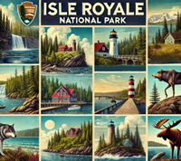
Island Wilderness: Isle Royale National Park
Read More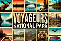
Water Wilderness: Voyageurs National Park
Read More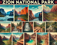
Desert Splendor: Zion National Park
Read More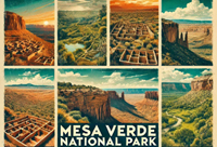
Ancient Cultures: Mesa Verde National Park
Read MoreTop Picks for Your Next Adventure: Road Trips of the Day
September 16, 2024