Embark on a journey curated by seasoned explorers William and Hui Cha Stanek, who have spent decades immersing themselves in the diverse landscapes of North America. These itineraries are more than just travel plans - they are thoughtfully crafted adventures designed to help you connect with the natural world, discover hidden gems, and create lasting memories.
National Parks Index | US Itineraries Index | American Roadtrips Index

Bring home a Bugville Critters book and watch as your child's love for reading and learning grows with every page. Hand-painted illustrations bring the heartwarming stories to life. Ask your librarian to add Bugville Critters to the library's digital collection today!
Discover William Stanek's Exclusive Art Collection
Explore and purchase the stunning art featured on this site. Own a piece of William Stanek's unique and captivating artwork today!
(September 16, 2024) A 5-Day Adventure: Exploring the Columbia River Gorge, Mount Hood, and Beyond from Portland
Introduction: A Personal Journey
Hui Cha's Encounter with the Columbia River Gorge
William and I lived near Portland for several years. The first time we drove out of Portland and into the Columbia River Gorge, I was struck by the sheer power of the landscape. The city, with its bustling streets and lively energy, faded into the background as we were enveloped by the towering cliffs and roaring waterfalls. I remember the moment we turned onto the Historic Columbia River Highway, and the first glimpse of Multnomah Falls came into view. The cascade of water, plunging from such a height, seemed almost otherworldly, like something out of a dream.
William and I pulled over to the side of the road and just stood there, mesmerized by the sight. The air was cool and damp, filled with the mist from the falls, and the sound of the water crashing down filled our ears. It was one of those moments that stays with you – a moment of pure awe and connection with the natural world. As we continued our journey along the gorge, each new waterfall, each sweeping view of the river, added to the sense that we were traveling through a landscape shaped by time and nature's relentless forces.
But this trip was about more than just the gorge. Mount Hood, with its snow-capped peak towering over the landscape, promised new adventures, from hiking through alpine meadows to exploring the historic Timberline Lodge. Over the next five days, we would immerse ourselves in the wild beauty of Oregon, discovering hidden trails, tranquil lakes, and the simple joy of being surrounded by nature.
This itinerary is a reflection of our journey – a journey that began and ended in Portland, but took us through some of the most breathtaking landscapes we've ever encountered. We invite you to join us on this adventure, to explore the wonders of the Columbia River Gorge, Mount Hood, and beyond, and to find your own moments of connection and awe in Oregon's majestic wilderness.
Day 1: From Portland to the Columbia River Gorge
Morning: Departure from Portland and Scenic Drive Along the Historic Columbia River Highway
Overview
Your adventure begins in Portland, where you'll set out on a scenic drive along the Historic Columbia River Highway, one of the most beautiful roads in the Pacific Northwest. This winding route takes you through the Columbia River Gorge, offering stunning views of the river, lush forests, and numerous waterfalls.
Tips from William
"The drive along the Historic Columbia River Highway is a photographer's dream. Bring a wide-angle lens to capture the expansive views of the gorge and a telephoto lens for close-ups of the waterfalls. The best light for photography is in the morning when the sun is low and the mist from the waterfalls creates a soft, ethereal atmosphere."
Insights from Hui Cha
"Driving along this highway feels like stepping back in time. The road was built to showcase the beauty of the gorge, and each turn reveals a new vista more breathtaking than the last. The sight of the river winding its way through the cliffs, the sound of the waterfalls cascading down, and the feel of the cool, misty air create a sense of peace and wonder."
How to Access the Historic Columbia River Highway
Directions:
- From Portland, take I-84 east toward the Columbia River Gorge. Exit at Corbett (Exit 22) to access the Historic Columbia River Highway.
Scenic Drive Details:
- Location: Columbia River Gorge, OR
- Difficulty: Easy (Driving)
Photography Tips: For the best shots along the highway, stop at various viewpoints such as Vista House at Crown Point, which offers panoramic views of the gorge. A polarizing filter can help reduce glare and enhance the colors of the river and forests.
Alternative Activity: If you prefer a more active start to your day, consider stopping at Latourell Falls, where you can take a short hike to the base of the waterfall and enjoy the sights and sounds of the cascading water.
Mid-Morning: Hike to Multnomah Falls and Wahkeena Falls Loop
Overview
After taking in the views from the highway, stop at Multnomah Falls, the most famous waterfall in the gorge. From there, embark on a hike along the Multnomah-Wahkeena Loop Trail, a popular trail that connects Multnomah Falls with nearby Wahkeena Falls. The trail offers stunning views of both waterfalls, as well as lush forests and tranquil streams.
Tips from William
"The Multnomah-Wahkeena Loop is perfect for waterfall and forest photography. Bring a wide-angle lens to capture the full height of the waterfalls and a polarizing filter to enhance the colors of the surrounding vegetation. The best light for photography is in the late morning when the sun is high enough to illuminate the falls but not too harsh."
Insights from Hui Cha
"Hiking this loop is like stepping into a fairytale. The sight of the waterfalls cascading down the cliffs, the sound of the water rushing over the rocks, and the feel of the cool, damp air create a sense of wonder and connection to the natural world."
How to Access Multnomah Falls and the Wahkeena Loop Trail
Directions:
- Multnomah Falls is located about 30 miles east of Portland along the Historic Columbia River Highway. Parking is available at the Multnomah Falls parking lot (Exit 31 off I-84).
Trail Details:
- Trail Length: 5 miles round-trip
- Elevation Gain: 1,600 feet
- Difficulty: Moderate
Photography Tips: For the best shots of Multnomah Falls, position yourself on Benson Bridge, which offers a unique perspective of the falls as they cascade down into the pool below. At Wahkeena Falls, experiment with long exposures to create a silky effect with the water.
Alternative Activity: If the full loop sounds too strenuous, consider taking a shorter hike to the top of Multnomah Falls, where you can enjoy beautiful views of the Columbia River Gorge without the additional elevation gain.
Afternoon: Picnic at Bridal Veil Falls and Explore the Waterfalls of the Gorge
Overview
After your hike, enjoy a relaxing picnic at Bridal Veil Falls, another beautiful waterfall located along the Historic Columbia River Highway. The area offers a peaceful spot to rest and enjoy the natural beauty of the gorge. After lunch, continue your exploration of the gorge with visits to other nearby waterfalls, such as Horsetail Falls and Oneonta Gorge.
Tips from William
"Bridal Veil Falls is a great spot for landscape and close-up photography. Bring a telephoto lens to capture the details of the waterfall and surrounding vegetation, and a wide-angle lens for the full view of the falls."
Insights from Hui Cha
"Picnicking at Bridal Veil Falls, with the sound of the water cascading down and the cool breeze rustling through the trees, is a perfect way to relax and take in the beauty of the gorge. Each waterfall in the area has its own unique charm, and exploring them is like discovering a series of hidden gems."
How to Access Bridal Veil Falls and Nearby Waterfalls
Directions:
- Bridal Veil Falls is located about 35 miles east of Portland along the Historic Columbia River Highway. Parking is available at the Bridal Veil Falls parking area.
Waterfall Details:
- Location: Columbia River Gorge, OR
- Difficulty: Easy to Moderate (depending on the waterfall)
Photography Tips: For the best shots at Bridal Veil Falls, use a tripod to stabilize your camera for long exposures, which can create a silky effect with the water. At Horsetail Falls, position yourself at the base of the falls to capture the full height and flow of the water.
Alternative Activity: If you prefer to explore a different area, consider taking a short drive to the town of Cascade Locks, where you can visit the Bridge of the Gods and enjoy beautiful views of the Columbia River.
Evening: Sunset at Rowena Crest Viewpoint
Overview
End your first day in the Columbia River Gorge with a sunset visit to Rowena Crest Viewpoint, one of the most scenic spots in the area. Located along the Mosier-The Dalles Highway, Rowena Crest offers panoramic views of the gorge, the river, and the rolling hills of the surrounding landscape. It's a perfect spot to watch the sun set over the gorge and reflect on the beauty of the day.
Tips from William
"Rowena Crest is a fantastic spot for sunset photography. Bring a tripod to stabilize your camera for long exposures and a wide-angle lens to capture the full scope of the landscape as the sun sets."
Insights from Hui Cha
"Watching the sunset from Rowena Crest is a moment of pure magic. The colors of the sky, the sight of the river winding through the gorge, and the sense of being surrounded by nature's beauty create a perfect ending to your first day of exploration."
How to Access Rowena Crest Viewpoint
Directions:
- Rowena Crest Viewpoint is located about 25 miles east of Hood River along the Mosier-The Dalles Highway (Highway 30). The drive from Bridal Veil Falls takes about 40 minutes.
Viewpoint Details:
- Location: Mosier-The Dalles Highway, OR
- Difficulty: Easy
Photography Tips: For the best shots at Rowena Crest, arrive early to scout a good location and capture the changing light as the sun sets. A graduated neutral density filter can help balance the exposure between the bright sky and the darker landscape below.
Alternative Activity: If Rowena Crest is too crowded or inaccessible, consider watching the sunset from the nearby Tom McCall Preserve, which offers equally stunning views of the gorge and the wildflower-covered hills.
Day 2: Exploring Mount Hood
Morning: Drive to Mount Hood and Hike the Timberline Trail
Overview
On your second day, leave the Columbia River Gorge behind and head south to Mount Hood, Oregon's highest peak. Begin your exploration with a hike along the Timberline Trail, a famous trail that circles the mountain and offers breathtaking views of the surrounding wilderness. Start your hike at Timberline Lodge, a historic lodge located at the base of the mountain, and make your way through alpine meadows, past glaciers, and along ridges with panoramic views.
Tips from William
"The Timberline Trail is perfect for landscape and mountain photography. Bring a wide-angle lens to capture the expansive views of the mountain and surrounding wilderness, and a telephoto lens for close-ups of the glaciers and wildflowers."
Insights from Hui Cha
"Hiking the Timberline Trail, with Mount Hood towering above you and the wilderness stretching out in every direction, is an awe-inspiring experience. The sight of the glaciers, the sound of the wind whistling through the trees, and the feeling of being surrounded by the raw beauty of nature create a deep connection to the landscape."
How to Access Timberline Trail
Directions:
- Timberline Lodge is located about 60 miles southeast of Portland along Highway 26. The drive takes about 1.5 hours, and parking is available at the lodge.
Trail Details:
- Trail Length: Variable (depending on how far you hike)
- Elevation Gain: Moderate (depending on the section of the trail)
- Difficulty: Moderate
Photography Tips: For the best shots along the Timberline Trail, use a small aperture (f/16 or smaller) to keep the entire scene in focus, and experiment with different compositions to highlight the layers of the landscape.
Alternative Activity: If the full Timberline Trail sounds too challenging, consider taking a shorter hike along the nearby Pacific Crest Trail, which offers beautiful views of Mount Hood and the surrounding wilderness without the additional elevation gain.
Mid-Morning: Visit Trillium Lake
Overview
After your hike, take a short drive to Trillium Lake, a picturesque alpine lake located at the base of Mount Hood. The lake offers stunning views of the mountain reflected in the water, making it a popular spot for photography, picnicking, and kayaking. Spend some time exploring the area, taking photos, or simply relaxing by the water.
Tips from William
"Trillium Lake is a fantastic spot for reflection photography. Bring a wide-angle lens to capture the reflection of Mount Hood in the water, and a polarizing filter to reduce glare and enhance the colors of the sky and lake."
Insights from Hui Cha
"Visiting Trillium Lake, with its tranquil waters and stunning views of Mount Hood, is a peaceful and rejuvenating experience. The sight of the mountain reflected in the lake, the sound of the water gently lapping at the shore, and the feel of the cool breeze create a perfect moment of connection to the natural world."
How to Access Trillium Lake
Directions:
- Trillium Lake is located about 5 miles south of Timberline Lodge along Highway 26. The drive takes about 15 minutes, and parking is available at the lake.
Lake Details:
- Location: Mount Hood National Forest, OR
- Difficulty: Easy
Photography Tips: For the best shots at Trillium Lake, position yourself on the shore in the early morning or late afternoon when the light is soft and the water is calm. A tripod can help stabilize your camera for sharp images, especially in low light.
Alternative Activity: If Trillium Lake is too crowded, consider visiting nearby Mirror Lake, another beautiful spot with stunning views of Mount Hood reflected in the water.
Afternoon: Lunch at Timberline Lodge and Explore the Lodge
Overview
After your visit to Trillium Lake, return to Timberline Lodge for a relaxing lunch. The lodge, built in the 1930s as part of the Works Progress Administration, is a National Historic Landmark and offers a unique combination of rustic charm and modern comfort. After lunch, take some time to explore the lodge, with its beautiful woodwork, cozy fireplaces, and stunning views of Mount Hood.
Tips from William
"Timberline Lodge is a great spot for architectural and lifestyle photography. Bring a portrait lens to capture the details of the lodge's woodwork and a wide-angle lens for environmental shots that include the surrounding landscape."
Insights from Hui Cha
"Lunch at Timberline Lodge, with its warm, rustic atmosphere and stunning views of Mount Hood, is a perfect way to relax and recharge after a morning of exploration. The sight of the mountain through the lodge's large windows, the sound of the crackling fire, and the feel of the cozy wooden interior create a sense of comfort and connection to the history of the area."
How to Access Timberline Lodge
Directions:
- Timberline Lodge is located about 60 miles southeast of Portland along Highway 26. The drive from Trillium Lake takes about 15 minutes.
Lodge Details:
- Location: Mount Hood, OR
- Difficulty: Easy
Photography Tips: For the best shots at Timberline Lodge, use a wide aperture to create a soft, blurred background that focuses attention on the details of the lodge's interior. A polarizing filter can help reduce glare from the windows and enhance the colors of the wood and stone.
Alternative Activity: If you prefer a more active afternoon, consider taking a scenic drive along the Mount Hood Scenic Byway, which offers stunning views of the mountain and the surrounding wilderness.
Evening: Sunset at Lost Lake
Overview
End your day with a sunset visit to Lost Lake, a serene and picturesque lake located on the northwest side of Mount Hood. The lake offers stunning views of the mountain reflected in the water, as well as beautiful hiking trails and opportunities for kayaking and canoeing. It's a perfect spot to watch the sun set over Mount Hood and reflect on the beauty of the day.
Tips from William
"Lost Lake is a fantastic spot for sunset photography. Bring a tripod to stabilize your camera for long exposures and a wide-angle lens to capture the full scope of the lake and mountain as the sun sets."
Insights from Hui Cha
"Watching the sunset at Lost Lake, with Mount Hood glowing in the fading light and the lake reflecting the colors of the sky, is a moment of pure magic. The sight of the mountain, the sound of the water gently lapping at the shore, and the sense of being surrounded by nature create a perfect ending to your day on Mount Hood."
How to Access Lost Lake
Directions:
- Lost Lake is located about 35 miles northwest of Timberline Lodge along Lost Lake Road. The drive takes about an hour, and parking is available at the lake.
Lake Details:
- Location: Mount Hood National Forest, OR
- Difficulty: Easy
Photography Tips: For the best shots at Lost Lake, position yourself on the shore in the early evening to capture the changing light as the sun sets. A graduated neutral density filter can help balance the exposure between the bright sky and the darker lake.
Alternative Activity: If Lost Lake is too crowded or inaccessible, consider watching the sunset from the nearby Ramona Falls Trailhead, which offers beautiful views of the forest and surrounding landscape.
Day 3: Exploring Hood River and the Fruit Loop
Morning: Drive to Hood River and Explore the Town
Overview
On your third day, head north to the town of Hood River, a charming riverside town known for its outdoor activities, vibrant arts scene, and stunning views of the Columbia River Gorge. Spend the morning exploring the town, with its eclectic mix of shops, cafes, and galleries, and take a stroll along the waterfront to watch the windsurfers and kiteboarders on the river.
Tips from William
"Hood River is a great spot for street and documentary photography. Bring a portrait lens to capture the details of the town's architecture and the people you meet, and a wide-angle lens for environmental portraits that include the surrounding landscape."
Insights from Hui Cha
"Exploring Hood River, with its vibrant energy and beautiful setting along the Columbia River, is a fun and engaging experience. The sight of the colorful shops and cafes, the sound of the river rushing by, and the feeling of being surrounded by the natural beauty of the gorge create a perfect morning in this charming town."
How to Access Hood River
Directions:
- Hood River is located about 60 miles east of Portland along I-84. The drive takes about an hour, and parking is available throughout the town.
Town Details:
- Location: Hood River, OR
- Difficulty: Easy
Photography Tips: For the best shots in Hood River, position yourself along the waterfront in the early morning to capture the soft light on the river and the windsurfers in action. A polarizing filter can help reduce glare and enhance the colors of the water and sky.
Alternative Activity: If you prefer a more active morning, consider renting a bike and exploring the Hood River Waterfront Trail, a scenic trail that runs along the river and offers beautiful views of the gorge and surrounding mountains.
Mid-Morning: Drive the Hood River Fruit Loop
Overview
After exploring Hood River, embark on a scenic drive along the Hood River Fruit Loop, a 35-mile loop that takes you through the fertile farmlands and orchards of the Hood River Valley. The loop is known for its stunning views of Mount Hood, as well as its abundance of farm stands, wineries, and cideries. Take your time exploring the area, stopping to sample fresh fruit, wine, and other local products along the way.
Tips from William
"The Hood River Fruit Loop is perfect for landscape and agricultural photography. Bring a wide-angle lens to capture the expansive views of the orchards and vineyards, and a macro lens for close-ups of the fruit and flowers."
Insights from Hui Cha
"Driving the Hood River Fruit Loop, with its rolling hills, lush orchards, and stunning views of Mount Hood, is a peaceful and enjoyable experience. The sight of the orchards stretching out before you, the smell of the fresh fruit, and the taste of the local wine create a perfect morning in the Hood River Valley."
How to Access the Hood River Fruit Loop
Directions:
- The Hood River Fruit Loop begins and ends in Hood River, and the loop is well-signposted with directions to various farm stands and wineries.
Loop Details:
- Location: Hood River Valley, OR
- Difficulty: Easy (Driving)
Photography Tips: For the best shots along the Hood River Fruit Loop, position yourself with Mount Hood in the background and use a polarizing filter to enhance the colors of the sky and orchards. A tripod can help stabilize your camera for sharp images, especially in low light.
Alternative Activity: If you prefer a more focused experience, consider visiting a specific winery or cidery along the loop, where you can enjoy a tasting and learn more about the local products.
Afternoon: Picnic at Panorama Point and Explore the Hood River Wineries
Overview
After your drive along the Fruit Loop, enjoy a relaxing picnic at Panorama Point, a scenic viewpoint that offers breathtaking views of the Hood River Valley and Mount Hood. After lunch, continue your exploration of the area with visits to some of the local wineries, where you can sample a variety of wines and learn about the winemaking process.
Tips from William
"Panorama Point is a fantastic spot for landscape photography. Bring a wide-angle lens to capture the full scope of the valley and Mount Hood, and a polarizing filter to reduce glare and enhance the colors of the sky and vineyards."
Insights from Hui Cha
"Picnicking at Panorama Point, with its stunning views of the Hood River Valley and Mount Hood, is a peaceful and rejuvenating experience. The sight of the vineyards stretching out before you, the taste of the fresh food, and the feel of the warm sun create a perfect afternoon in the Hood River Valley."
How to Access Panorama Point
Directions:
- Panorama Point is located about 5 miles south of Hood River along Eastside Road. The drive takes about 15 minutes, and parking is available at the viewpoint.
Viewpoint and Winery Details:
- Location: Hood River Valley, OR
- Difficulty: Easy
Photography Tips: For the best shots at Panorama Point, arrive in the early afternoon to capture the clear, bright light on the valley and Mount Hood. A small aperture (f/16 or smaller) will keep the entire scene in focus, and a tripod can help stabilize your camera for sharp images.
Alternative Activity: If you prefer a more active afternoon, consider taking a hike along the nearby Tamanawas Falls Trail, a scenic trail that takes you through lush forests to a beautiful waterfall.
Evening: Dinner in Hood River and Sunset at Rowena Crest
Overview
After a day of exploration in the Hood River Valley, return to Hood River for a relaxing dinner at one of the town's many restaurants, where you can enjoy fresh, locally sourced cuisine. After dinner, take a short drive to Rowena Crest, where you can watch the sunset over the Columbia River Gorge and reflect on the beauty of the day.
Tips from William
"Hood River is a great spot for food and lifestyle photography. Bring a portrait lens to capture the details of the dishes and the ambiance of the restaurant, and a wide-angle lens for environmental shots that include the surrounding landscape."
Insights from Hui Cha
"Dinner in Hood River, with its vibrant energy and delicious local food, is a perfect way to end your day. The sight of the river through the restaurant windows, the sound of the people enjoying their meals, and the taste of the fresh, locally sourced cuisine create a sense of connection to the area and its people."
How to Access Dinner in Hood River and Sunset at Rowena Crest
Directions:
- Hood River is located about 60 miles east of Portland along I-84. The drive to Rowena Crest takes about 15 minutes.
Dining and Viewpoint Details:
- Location: Hood River, OR, and Rowena Crest Viewpoint
- Cuisine: Farm-to-table, Pacific Northwest, international
Photography Tips: For the best shots during your dinner, focus on capturing the ambiance of the restaurant and the details of the dishes. At Rowena Crest, arrive early to scout a good location and capture the changing light as the sun sets.
Alternative Activity: If Rowena Crest is too crowded or inaccessible, consider watching the sunset from the Hood River Waterfront Park, where you can enjoy beautiful views of the river and the surrounding landscape.
Day 4: Exploring Mount St. Helens and Gifford Pinchot National Forest
Morning: Drive to Mount St. Helens and Visit the Johnston Ridge Observatory
Overview
On your fourth day, cross the Columbia River into Washington and head to Mount St. Helens, one of the most famous volcanoes in the United States. Begin your exploration with a visit to the Johnston Ridge Observatory, located just 5 miles from the volcano's crater. The observatory offers stunning views of the mountain, as well as exhibits on the 1980 eruption and its aftermath.
Tips from William
"Mount St. Helens is perfect for landscape and geological photography. Bring a wide-angle lens to capture the expansive views of the volcano and surrounding landscape, and a telephoto lens for close-ups of the crater and blast zone."
Insights from Hui Cha
"Visiting Mount St. Helens, with its dramatic landscape and powerful history, is a humbling experience. The sight of the volcano's crater, the sound of the wind whistling through the barren landscape, and the knowledge of the eruption's impact create a deep connection to the power of nature."
How to Access Johnston Ridge Observatory
Directions:
- The Johnston Ridge Observatory is located about 50 miles north of Portland along Highway 504. The drive takes about 1.5 hours, and parking is available at the observatory.
Observatory Details:
- Location: Mount St. Helens, WA
- Difficulty: Easy
Photography Tips: For the best shots at Mount St. Helens, arrive in the early morning to capture the soft light on the volcano and surrounding landscape. A polarizing filter can help reduce glare and enhance the colors of the sky and volcanic rock.
Alternative Activity: If you prefer a more active morning, consider taking a hike along the Harry's Ridge Trail, a moderately challenging trail that offers stunning views of Mount St. Helens and the surrounding blast zone.
Mid-Morning: Hike the Ape Cave Lava Tubes
Overview
After your visit to Mount St. Helens, head to the nearby Ape Cave Lava Tubes, one of the longest lava tubes in North America. The caves offer a unique opportunity to explore the underground world created by the volcanic eruption, with narrow passages, dark chambers, and fascinating geological formations. Be sure to bring a flashlight or headlamp, as the caves can be very dark.
Tips from William
"The Ape Cave Lava Tubes are perfect for cave and geological photography. Bring a wide-angle lens to capture the narrow passages and chambers, and a waterproof camera or GoPro for the dark, damp sections of the cave."
Insights from Hui Cha
"Exploring the Ape Cave Lava Tubes is a thrilling and otherworldly experience. The sight of the lava-formed passages, the sound of your footsteps echoing through the cave, and the feel of the cool, damp air create a sense of adventure and wonder."
How to Access the Ape Cave Lava Tubes
Directions:
- The Ape Cave Lava Tubes are located about 20 miles south of Mount St. Helens along Forest Road 83. The drive takes about 45 minutes, and parking is available at the cave entrance.
Cave Details:
- Location: Gifford Pinchot National Forest, WA
- Difficulty: Moderate
Photography Tips: For the best shots inside the Ape Cave, use a tripod to stabilize your camera for long exposures in the low light of the cave. A fast shutter speed can help capture the movement of the light from your flashlight or headlamp.
Alternative Activity: If exploring the lava tubes sounds too challenging, consider taking a hike along the nearby Trail of Two Forests, an easier trail that offers beautiful views of the forest and surrounding landscape.
Afternoon: Picnic at Coldwater Lake and Explore the Gifford Pinchot National Forest
Overview
After your cave exploration, enjoy a relaxing picnic at Coldwater Lake, a beautiful lake formed by the eruption of Mount St. Helens. The lake offers stunning views of the surrounding mountains and forests, as well as opportunities for kayaking, fishing, and hiking. After lunch, continue your exploration of the Gifford Pinchot National Forest, with its dense forests, rushing rivers, and tranquil meadows.
Tips from William
"Coldwater Lake is a great spot for landscape and reflection photography. Bring a wide-angle lens to capture the reflections of the surrounding mountains in the water, and a polarizing filter to reduce glare and enhance the colors of the lake and sky."
Insights from Hui Cha
"Picnicking at Coldwater Lake, with its serene waters and stunning views of the mountains, is a peaceful and rejuvenating experience. The sight of the lake's calm surface, the sound of the water gently lapping at the shore, and the feel of the cool mountain air create a perfect afternoon in the Gifford Pinchot National Forest."
How to Access Coldwater Lake
Directions:
- Coldwater Lake is located about 10 miles east of the Johnston Ridge Observatory along Highway 504. The drive takes about 20 minutes, and parking is available at the lake.
Lake and Forest Details:
- Location: Gifford Pinchot National Forest, WA
- Difficulty: Easy
Photography Tips: For the best shots at Coldwater Lake, position yourself on the shore in the early afternoon to capture the clear, bright light on the lake and surrounding mountains. A small aperture (f/16 or smaller) will keep the entire scene in focus, and a tripod can help stabilize your camera for sharp images.
Alternative Activity: If you prefer a more active afternoon, consider renting a kayak and exploring the lake from the water, where you can enjoy beautiful views of the surrounding mountains and forests.
Evening: Return to Portland and Dinner in the City
Overview
After a day of exploration in the Gifford Pinchot National Forest, return to Portland for a relaxing evening in the city. Enjoy dinner at one of Portland's many renowned restaurants, where you can savor a variety of cuisines made with fresh, locally sourced ingredients. After dinner, take a stroll through one of Portland's vibrant neighborhoods, where you can experience the city's lively arts scene and unique culture.
Tips from William
"Portland is a great spot for food and lifestyle photography. Bring a portrait lens to capture the details of the dishes and the ambiance of the restaurant, and a wide-angle lens for environmental shots that include the surrounding neighborhood."
Insights from Hui Cha
"Dinner in Portland, with its vibrant energy and delicious local food, is a perfect way to end your day. The sight of the city lights through the restaurant windows, the sound of the people enjoying their meals, and the taste of the fresh, locally sourced cuisine create a sense of connection to the city and its culture."
How to Access Dinner in Portland
Directions:
- Portland is located about 50 miles south of Mount St. Helens along I-5. The drive takes about an hour.
Dining Details:
- Location: Portland, OR
- Cuisine: Farm-to-table, Pacific Northwest, international
Photography Tips: For the best shots during your dinner, focus on capturing the ambiance of the restaurant and the details of the dishes. A wide aperture can help create a beautiful bokeh effect with the city lights in the background.
Alternative Activity: If you prefer a more casual evening, consider picking up some takeout from a local food cart and having a picnic in one of Portland's many parks, where you can enjoy the city's vibrant atmosphere and beautiful green spaces.
Day 5: Exploring the Columbia River Gorge on the Washington Side
Morning: Drive to Beacon Rock State Park and Hike Beacon Rock
Overview
On your final day, cross the Columbia River into Washington and head to Beacon Rock State Park, a beautiful park located on the Washington side of the gorge. Begin your exploration with a hike up Beacon Rock, an iconic rock formation that offers stunning views of the Columbia River and surrounding landscape. The trail is relatively short but steep, with switchbacks that take you to the summit, where you can enjoy panoramic views of the gorge.
Tips from William
"Beacon Rock is perfect for landscape and panoramic photography. Bring a wide-angle lens to capture the expansive views of the gorge and a telephoto lens for close-ups of the rock formations and river."
Insights from Hui Cha
"Hiking up Beacon Rock, with its steep switchbacks and breathtaking views, is a thrilling and rewarding experience. The sight of the Columbia River stretching out below you, the sound of the wind whistling through the rock formations, and the feeling of accomplishment as you reach the summit create a perfect start to your final day of exploration."
How to Access Beacon Rock State Park
Directions:
- Beacon Rock State Park is located about 35 miles east of Portland along Highway 14. The drive takes about an hour, and parking is available at the park entrance.
Trail Details:
- Trail Length: 2 miles round-trip
- Elevation Gain: 850 feet
- Difficulty: Moderate
Photography Tips: For the best shots at Beacon Rock, arrive in the early morning to capture the soft light on the rock formations and river. A small aperture (f/16 or smaller) will keep the entire scene in focus, and a tripod can help stabilize your camera for sharp images.
Alternative Activity: If the hike up Beacon Rock sounds too challenging, consider taking a walk along the Columbia River waterfront at the nearby town of Stevenson, where you can enjoy beautiful views of the river and surrounding landscape.
Mid-Morning: Explore Cape Horn Trail
Overview
After your hike at Beacon Rock, head west to the Cape Horn Trail, a beautiful trail that offers stunning views of the Columbia River Gorge from the Washington side. The trail takes you through lush forests, past waterfalls, and along cliffs with panoramic views of the river. The trail is moderately challenging, with some steep sections, but the views from the top are well worth the effort.
Tips from William
"The Cape Horn Trail is perfect for landscape and waterfall photography. Bring a wide-angle lens to capture the expansive views of the gorge and a polarizing filter to enhance the colors of the waterfalls and surrounding vegetation."
Insights from Hui Cha
"Hiking the Cape Horn Trail, with its lush forests, beautiful waterfalls, and stunning views of the Columbia River Gorge, is a peaceful and rewarding experience. The sight of the river winding its way through the gorge, the sound of the waterfalls cascading down the cliffs, and the feel of the cool, damp air create a deep connection to the natural beauty of the area."
How to Access the Cape Horn Trail
Directions:
- The Cape Horn Trailhead is located about 10 miles west of Beacon Rock State Park along Highway 14. The drive takes about 20 minutes, and parking is available at the trailhead.
Trail Details:
- Trail Length: 7 miles round-trip
- Elevation Gain: 1,300 feet
- Difficulty: Moderate
Photography Tips: For the best shots along the Cape Horn Trail, position yourself on the cliffs in the mid-morning to capture the clear, bright light on the river and surrounding landscape. A polarizing filter can help reduce glare and enhance the colors of the sky and vegetation.
Alternative Activity: If the full Cape Horn Trail sounds too strenuous, consider taking a shorter walk along the Lower Cape Horn Loop, which offers beautiful views of the river and waterfalls with less elevation gain.
Afternoon: Picnic at Skamania Lodge and Explore Stevenson
Overview
After your hike, enjoy a relaxing picnic at Skamania Lodge, a beautiful lodge located in the town of Stevenson. The lodge offers stunning views of the Columbia River Gorge, as well as opportunities for hiking, golfing, and spa treatments. After lunch, take some time to explore the town of Stevenson, with its charming shops, cafes, and waterfront park.
Tips from William
"Skamania Lodge is a great spot for landscape and lifestyle photography. Bring a wide-angle lens to capture the views of the gorge and a portrait lens for environmental shots that include the lodge's beautiful grounds."
Insights from Hui Cha
"Picnicking at Skamania Lodge, with its stunning views of the Columbia River Gorge and peaceful surroundings, is a perfect way to relax and reflect on your journey. The sight of the river through the lodge's large windows, the sound of the wind rustling through the trees, and the feel of the warm sun create a sense of peace and connection to the natural beauty of the area."
How to Access Skamania Lodge and Stevenson
Directions:
- Skamania Lodge is located about 5 miles west of the Cape Horn Trail along Highway 14. The drive takes about 15 minutes.
Lodge and Town Details:
- Location: Stevenson, WA
- Difficulty: Easy
Photography Tips: For the best shots at Skamania Lodge, position yourself on the terrace or in the gardens to capture the views of the Columbia River Gorge. A polarizing filter can help reduce glare and enhance the colors of the sky and river.
Alternative Activity: If you prefer a more active afternoon, consider taking a hike along the Wind Mountain Trail, a short but steep trail that offers stunning views of the Columbia River Gorge from the top.
Evening: Return to Portland and Farewell Dinner
Overview
After a day of exploration on the Washington side of the Columbia River Gorge, return to Portland for a farewell dinner in the city. Choose one of Portland's many renowned restaurants, where you can savor a variety of cuisines made with fresh, locally sourced ingredients. After dinner, take a leisurely stroll through one of Portland's vibrant neighborhoods, reflecting on the incredible journey you've just completed.
Tips from William
"Portland is a great spot for food and lifestyle photography. Bring a portrait lens to capture the details of the dishes and the ambiance of the restaurant, and a wide-angle lens for environmental shots that include the surrounding neighborhood."
Insights from Hui Cha
"Your farewell dinner in Portland, with its vibrant energy and delicious local food, is a perfect way to end your journey. The sight of the city lights through the restaurant windows, the sound of the people enjoying their meals, and the taste of the fresh, locally sourced cuisine create a sense of connection to the city and its culture."
How to Access Dinner in Portland
Directions:
- Portland is located about 35 miles west of Stevenson along I-84. The drive takes about 45 minutes.
Dining Details:
- Location: Portland, OR
- Cuisine: Farm-to-table, Pacific Northwest, international
Photography Tips: For the best shots during your dinner, focus on capturing the ambiance of the restaurant and the details of the dishes. A wide aperture can help create a beautiful bokeh effect with the city lights in the background.
Alternative Activity: If you prefer a more casual evening, consider picking up some takeout from a local food cart and having a picnic in one of Portland's many parks, where you can enjoy the city's vibrant atmosphere and beautiful green spaces.
Conclusion: A Personal Reflection
Hui Cha's Reflection on the Journey
As we drove back into Portland, with the city lights twinkling in the distance, I felt a deep sense of fulfillment. Over the past five days, we had explored some of the most beautiful and diverse landscapes the Pacific Northwest has to offer – from the roaring waterfalls of the Columbia River Gorge to the snow-capped peak of Mount Hood, from the dramatic crater of Mount St. Helens to the peaceful orchards of the Hood River Valley.
But more than that, this journey had given us the opportunity to reconnect with nature and with each other. In the midst of our busy lives, it's easy to forget the simple joys of being outdoors, of breathing in the fresh mountain air, of listening to the sound of the wind rustling through the trees. This trip reminded us of those joys, and of the importance of taking the time to experience them.
As we sat down for our farewell dinner, I reflected on the incredible journey we had just completed – the moments of awe and wonder, the sense of peace and connection, the memories we would carry with us long after we returned home. These landscapes, with their timeless beauty and serene wilderness, had touched something deep within us, and I knew that we would return, again and again, to find renewal and inspiration in the embrace of Oregon's majestic wilderness.

Step into a world of timeless beauty with our premium, oversized hardcover book - crafted for discerning collectors and anyone who values the power of art. Perfect for your coffee table, it's more than just a book; it's a conversation starter, a window into over 30 years of William's visionary photography.
Your Support Matters
Purchasing artwork from William Stanek's collection not only brings beauty into your life but also helps us continue to share. Thank you for supporting our creative journey!
Discover Reader Favorites: Must-See USA Itineraries for Monday
September 16, 2024
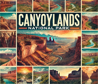
A 3-Day Journey Through Time and Stone: Exploring Arches and Canyonlands
Read More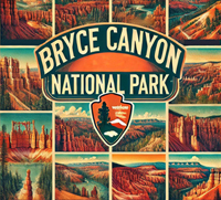
A 3-Day Journey Through Nature's Sculpted Masterpieces: Exploring Bryce Canyon and Zion
Read More
St. Thomas, St. John, and Virgin Islands National Park: A 5-Day Caribbean Adventure
Read More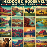
2-Day Journey into The Rugged Beauty of the Dakotas: Theodore Roosevelt and Badlands
Read MoreDiscover Your Next Great Escape: 1-5 Day Itineraries for All 63 US National Parks
Trending Today: Top National Park Guides
September 16, 2024
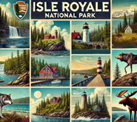
Island Wilderness: Isle Royale National Park
Read More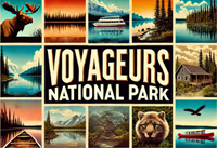
Water Wilderness: Voyageurs National Park
Read More
Desert Splendor: Zion National Park
Read More
Ancient Cultures: Mesa Verde National Park
Read MoreTop Picks for Your Next Adventure: Road Trips of the Day
September 16, 2024