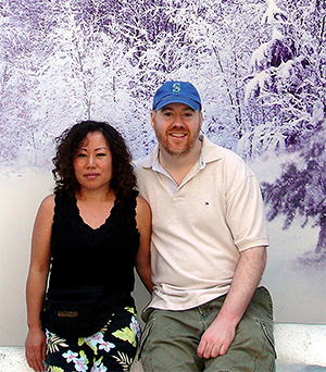
Embark on a journey curated by seasoned explorers William and Hui Cha Stanek, who have spent decades immersing themselves in the diverse landscapes of North America. These itineraries are more than just travel plans - they are thoughtfully crafted adventures designed to help you connect with the natural world, discover hidden gems, and create lasting memories.
National Parks Index | US Itineraries Index | American Roadtrips Index

Bring home a Bugville Critters book and watch as your child's love for reading and learning grows with every page. Hand-painted illustrations bring the heartwarming stories to life. Ask your librarian to add Bugville Critters to the library's digital collection today!
Discover William Stanek's Exclusive Art Collection
Explore and purchase the stunning art featured on this site. Own a piece of William Stanek's unique and captivating artwork today!
(February 5, 2025) A 5-Day Journey Through San Francisco, Napa Valley, and the Golden Gate: Exploring California's Iconic Landscapes
Introduction: A Personal Journey
William's Recent Experience at the Presidio of San Francisco
There's something truly magical about the drive across the Golden Gate Bridge into the Presidio of San Francisco. I remember the last time we visited vividly – Hui Cha and I had just arrived in the city, and the fog was beginning to lift, revealing the towering red-orange structure against the backdrop of the bay. The sight was both awe-inspiring and humbling, a perfect welcome to this storied city.
As we drove into the Presidio, I was struck by the contrast between the city's bustling energy and the serene, almost meditative quality of the park. The eucalyptus trees swayed gently in the breeze, and the sound of the ocean waves crashing against the cliffs below filled the air. We parked near the Main Post, and as we walked through the historic buildings, I could feel the weight of history all around us – a history that spanned centuries, from the Native American Ohlone people to the Spanish colonists, and eventually to the U.S. Army. This place, with its blend of natural beauty and rich history, felt like a gateway not just to the city but to the past.
Over the next five days, we would explore the best that this region has to offer – from the iconic landmarks of San Francisco to the rolling vineyards of Napa Valley, and the rugged coastline of the Golden Gate National Recreation Area. This itinerary is a reflection of our journey – a journey that began and ended in San Francisco but took us through some of the most breathtaking landscapes and fascinating histories that California has to offer. Join us as we explore these iconic destinations, each with its own unique charm and story to tell.
Day 1: Exploring San Francisco's Presidio and Golden Gate Park
Morning: Arrival in San Francisco and Introduction to the Presidio
Overview
Your adventure begins in San Francisco, where you'll start your exploration at the Presidio, a historic park located at the northern tip of the city. Once a military base, the Presidio is now a national park and one of the city's most beloved green spaces. Begin your visit at the Main Post, the heart of the Presidio, where you can explore historic buildings, museums, and scenic viewpoints.
Tips from William
"The Presidio offers fantastic opportunities for architectural and landscape photography. Bring a wide-angle lens to capture the historic buildings and a telephoto lens for close-ups of the details and surrounding landscapes. The best light for photography is in the early morning when the park is quiet and the fog often adds a mystical quality to the scene."
Insights from Hui Cha
"Walking through the Presidio, with its historic buildings and lush green spaces, feels like stepping into another time. The sight of the old barracks, the sound of the wind rustling through the trees, and the sense of history all around you create a unique and tranquil experience."
How to Access the Presidio
Directions:
- The Presidio is located at the northern end of San Francisco, just south of the Golden Gate Bridge. The Main Post is easily accessible by car, bike, or public transportation.
Park Details:
- Location: San Francisco, CA
- Difficulty: Easy
Photography Tips: For the best shots at the Presidio, position yourself at the Main Parade Ground, where you can capture wide views of the historic buildings with the Golden Gate Bridge in the background. A polarizing filter can help reduce glare and enhance the colors of the sky and vegetation.
Alternative Activity: If you prefer a more active start to your day, consider renting a bike and exploring the Presidio's extensive network of trails, which offer beautiful views of the bay and the Golden Gate Bridge.
Mid-Morning: Visit the Golden Gate Bridge and Fort Point
Overview
After exploring the Presidio, head to the iconic Golden Gate Bridge, one of the most famous landmarks in the world. Start with a visit to Fort Point, a historic fort located at the base of the bridge, where you can learn about the fort's role in the city's history and enjoy stunning views of the bridge from below. Afterward, take a walk along the Golden Gate Bridge, where you can experience the scale and beauty of this engineering marvel up close.
Tips from William
"The Golden Gate Bridge is perfect for architectural and landscape photography. Bring a wide-angle lens to capture the full length of the bridge and a telephoto lens for close-ups of the cables and towers. The best light for photography is in the late morning when the fog has often cleared and the sunlight enhances the bridge's iconic color."
Insights from Hui Cha
"Standing beneath the Golden Gate Bridge at Fort Point, with the waves crashing against the rocks and the bridge towering overhead, is a humbling experience. The sight of this massive structure, the sound of the water, and the knowledge of the history that has unfolded here create a deep connection to the city and its past."
How to Access the Golden Gate Bridge and Fort Point
Directions:
- Fort Point is located at the southern base of the Golden Gate Bridge, within the Presidio. Parking is available at the fort, and the bridge is a short walk away.
Bridge and Fort Details:
- Location: San Francisco, CA
- Difficulty: Easy to Moderate (depending on walking distance)
Photography Tips: For the best shots of the Golden Gate Bridge, position yourself at Fort Point in the mid-morning to capture the sunlight reflecting off the bridge. A graduated neutral density filter can help balance the exposure between the bright sky and the darker fort.
Alternative Activity: If walking across the bridge sounds too strenuous, consider taking a short drive to the nearby Crissy Field, where you can enjoy beautiful views of the bridge and bay with a more relaxed atmosphere.
Afternoon: Explore Golden Gate Park and Picnic at the Japanese Tea Garden
Overview
After your visit to the Golden Gate Bridge, head south to Golden Gate Park, one of the largest urban parks in the United States. The park offers a wide variety of attractions, including museums, gardens, and scenic lakes. Begin your exploration with a visit to the Japanese Tea Garden, a tranquil oasis within the park, where you can enjoy a relaxing picnic surrounded by beautiful plants, koi ponds, and traditional Japanese architecture.
Tips from William
"Golden Gate Park is perfect for landscape and garden photography. Bring a macro lens to capture the intricate details of the plants and flowers, and a wide-angle lens for environmental shots that include the traditional Japanese structures."
Insights from Hui Cha
"Exploring the Japanese Tea Garden, with its beautifully manicured gardens, serene ponds, and traditional tea house, is a peaceful and rejuvenating experience. The sight of the cherry blossoms in bloom, the sound of the water gently flowing through the garden, and the taste of the tea create a perfect moment of tranquility in the heart of the city."
How to Access Golden Gate Park and the Japanese Tea Garden
Directions:
- Golden Gate Park is located in the western part of San Francisco, just south of the Presidio. The Japanese Tea Garden is located near the eastern end of the park, close to the de Young Museum and California Academy of Sciences.
Park and Garden Details:
- Location: San Francisco, CA
- Difficulty: Easy
Photography Tips: For the best shots in the Japanese Tea Garden, arrive in the early afternoon when the sunlight filters through the trees, creating beautiful patterns of light and shadow. A polarizing filter can help reduce glare and enhance the colors of the foliage and water.
Alternative Activity: If the Japanese Tea Garden is too crowded, consider visiting the nearby Conservatory of Flowers, where you can explore a stunning collection of rare and exotic plants from around the world.
Evening: Sunset at Lands End and Dinner in the Marina District
Overview
End your first day in San Francisco with a sunset visit to Lands End, a rugged coastal area located at the western edge of the city. Lands End offers stunning views of the Golden Gate Bridge, the Pacific Ocean, and the Marin Headlands. Afterward, head to the nearby Marina District for a relaxing dinner at one of the many waterfront restaurants, where you can enjoy fresh seafood and beautiful views of the bay.
Tips from William
"Lands End is a fantastic spot for sunset photography. Bring a tripod to stabilize your camera for long exposures and a wide-angle lens to capture the full scope of the coastline and bridge as the sun sets."
Insights from Hui Cha
"Watching the sunset at Lands End, with the Golden Gate Bridge glowing in the fading light and the waves crashing against the rocks below, is a moment of pure magic. The colors of the sky, the sight of the bridge silhouetted against the horizon, and the sound of the ocean create a perfect ending to your first day in San Francisco."
How to Access Lands End and the Marina District
Directions:
- Lands End is located at the western edge of San Francisco, near the Sutro Baths. Parking is available at the Lands End Lookout, and the Marina District is a short drive away.
Viewpoint and Dining Details:
- Location: San Francisco, CA
- Cuisine: Seafood, farm-to-table, international
Photography Tips: For the best shots at Lands End, arrive early to scout a good location and capture the changing light as the sun sets. A graduated neutral density filter can help balance the exposure between the bright sky and the darker land.
Alternative Activity: If Lands End is too crowded or inaccessible, consider watching the sunset from the nearby Baker Beach, which offers equally stunning views of the Golden Gate Bridge and the Pacific Ocean.
Day 2: Crossing the Golden Gate and Exploring Marin County
Morning: Drive Across the Golden Gate Bridge and Visit the Marin Headlands
Overview
On your second day, leave the city behind and cross the Golden Gate Bridge into Marin County, home to some of the most beautiful natural landscapes in the Bay Area. Start your exploration with a visit to the Marin Headlands, a rugged coastal area known for its sweeping views of the Golden Gate Bridge, San Francisco Bay, and the Pacific Ocean. The headlands offer a variety of hiking trails, historic sites, and scenic viewpoints.
Tips from William
"The Marin Headlands are perfect for landscape and panoramic photography. Bring a wide-angle lens to capture the expansive views of the coastline and bridge, and a telephoto lens for close-ups of the waves and wildlife."
Insights from Hui Cha
"Exploring the Marin Headlands, with its rugged cliffs, windswept beaches, and breathtaking views, is an exhilarating experience. The sight of the Golden Gate Bridge stretching across the bay, the sound of the waves crashing against the shore, and the feeling of the wind in your hair create a deep connection to the wild beauty of this place."
How to Access the Marin Headlands
Directions:
- The Marin Headlands are located just north of the Golden Gate Bridge along Conzelman Road. The drive from San Francisco takes about 20 minutes, and parking is available at various viewpoints and trailheads.
Headlands Details:
- Location: Marin County, CA
- Difficulty: Easy to Moderate (depending on the trail)
Photography Tips: For the best shots in the Marin Headlands, position yourself at the Battery Spencer viewpoint in the early morning to capture the sunlight on the Golden Gate Bridge and San Francisco Bay. A polarizing filter can help reduce glare and enhance the colors of the sky and water.
Alternative Activity: If the Marin Headlands are too foggy or windy, consider visiting the nearby Muir Woods National Monument, where you can walk among ancient redwoods and enjoy the peaceful beauty of the forest.
Mid-Morning: Hike the Coastal Trail to Tennessee Valley
Overview
After exploring the Marin Headlands, take a hike along the Coastal Trail to Tennessee Valley, a beautiful trail that offers stunning views of the coastline, wildflower-covered hills, and the Pacific Ocean. The trail is moderately challenging, with some steep sections, but the views from the top are well worth the effort. The trail ends at Tennessee Beach, a secluded beach where you can relax and enjoy the natural beauty of the area.
Tips from William
"The Coastal Trail is perfect for landscape and nature photography. Bring a wide-angle lens to capture the expansive views of the coastline and hills, and a macro lens for close-ups of the wildflowers and vegetation."
Insights from Hui Cha
"Hiking the Coastal Trail, with its sweeping views of the Pacific Ocean and rugged coastline, is a peaceful and rejuvenating experience. The sight of the waves crashing against the cliffs, the sound of the wind rustling through the grass, and the feel of the sun on your face create a perfect moment of connection to the natural world."
How to Access the Coastal Trail and Tennessee Valley
Directions:
- The Coastal Trailhead is located near the Tennessee Valley parking area, just south of Mill Valley. The drive from the Marin Headlands takes about 15 minutes.
Trail Details:
- Trail Length: 3.4 miles round-trip
- Elevation Gain: 800 feet
- Difficulty: Moderate
Photography Tips: For the best shots along the Coastal Trail, position yourself on the cliffs in the mid-morning to capture the clear, bright light on the ocean and surrounding landscape. A polarizing filter can help reduce glare and enhance the colors of the sky and vegetation.
Alternative Activity: If the hike to Tennessee Valley sounds too challenging, consider taking a shorter walk along the nearby Tennessee Valley Trail, which offers beautiful views of the hills and a more relaxed atmosphere.
Afternoon: Picnic at Stinson Beach and Explore Point Reyes National Seashore
Overview
After your hike, head to Stinson Beach for a relaxing picnic by the ocean. Stinson Beach is one of the most popular beaches in the Bay Area, known for its soft sand, gentle waves, and stunning views of the Marin coastline. After lunch, continue your exploration of Marin County with a visit to Point Reyes National Seashore, a vast and wild coastal area known for its rugged cliffs, windswept beaches, and abundant wildlife.
Tips from William
"Stinson Beach and Point Reyes are perfect for seascape and wildlife photography. Bring a telephoto lens to capture the details of the waves and wildlife, and a wide-angle lens for environmental shots that include the beach and cliffs."
Insights from Hui Cha
"Picnicking at Stinson Beach, with its soft sand, gentle waves, and stunning views of the coastline, is a peaceful and rejuvenating experience. The sight of the ocean stretching out before you, the sound of the waves gently lapping at the shore, and the feel of the warm sun create a perfect afternoon in Marin County."
How to Access Stinson Beach and Point Reyes
Directions:
- Stinson Beach is located about 10 miles north of Tennessee Valley along Highway 1. The drive takes about 20 minutes, and parking is available at the beach. Point Reyes is located about 20 miles northwest of Stinson Beach.
Beach and Seashore Details:
- Location: Marin County, CA
- Difficulty: Easy
Photography Tips: For the best shots at Stinson Beach, position yourself near the water's edge in the early afternoon to capture the clear, bright light on the ocean and surrounding landscape. At Point Reyes, use a polarizing filter to reduce glare and enhance the colors of the sky and cliffs.
Alternative Activity: If you prefer a more active afternoon, consider taking a hike along the nearby Point Reyes Lighthouse Trail, which offers stunning views of the Pacific Ocean and the rugged coastline.
Evening: Return to San Francisco and Dinner in Sausalito
Overview
After a day of exploration in Marin County, return to San Francisco for a relaxing evening in the city. On your way back, stop in the charming town of Sausalito, located just across the Golden Gate Bridge. Sausalito offers a variety of waterfront restaurants where you can enjoy fresh seafood and beautiful views of the bay and San Francisco skyline. After dinner, take a leisurely stroll along the waterfront, reflecting on the beauty of the day.
Tips from William
"Sausalito is a great spot for food and lifestyle photography. Bring a portrait lens to capture the details of the dishes and the ambiance of the restaurant, and a wide-angle lens for environmental shots that include the surrounding waterfront and skyline."
Insights from Hui Cha
"Dinner in Sausalito, with its vibrant energy and beautiful views of the bay and San Francisco skyline, is a perfect way to end your day. The sight of the city lights twinkling in the distance, the sound of the waves gently lapping at the shore, and the taste of the fresh, locally sourced seafood create a sense of connection to the area and its people."
How to Access Dinner in Sausalito
Directions:
- Sausalito is located just north of the Golden Gate Bridge along Highway 101. The drive from Point Reyes takes about an hour, and parking is available throughout the town.
Dining Details:
- Location: Sausalito, CA
- Cuisine: Seafood, farm-to-table, international
Photography Tips: For the best shots during your dinner, focus on capturing the ambiance of the restaurant and the details of the dishes. A wide aperture can help create a beautiful bokeh effect with the city lights in the background.
Alternative Activity: If you prefer a more casual evening, consider picking up some takeout from a local market and having a picnic on the waterfront, where you can enjoy the stunning views of the bay and San Francisco skyline.
Day 3: Napa Valley Wine Country
Morning: Drive to Napa Valley and Visit a Historic Winery
Overview
On your third day, leave the city behind and head north to Napa Valley, one of the world's premier wine regions. Start your exploration with a visit to a historic winery, where you can learn about the winemaking process, tour the vineyards, and sample some of the region's finest wines. The valley's rolling hills, lush vineyards, and elegant estates create a picturesque setting for a day of relaxation and indulgence.
Tips from William
"Napa Valley is perfect for landscape and architectural photography. Bring a wide-angle lens to capture the sweeping views of the vineyards and a macro lens for close-ups of the grapes and flowers."
Insights from Hui Cha
"Visiting a historic winery in Napa Valley, with its lush vineyards, elegant architecture, and world-class wines, is a luxurious and relaxing experience. The sight of the vineyards stretching out before you, the taste of the fine wines, and the feel of the warm sun on your skin create a perfect morning in wine country."
How to Access Napa Valley and Historic Wineries
Directions:
- Napa Valley is located about 60 miles north of San Francisco along Highway 29. The drive takes about an hour and a half, and parking is available at most wineries.
Winery Details:
- Location: Napa Valley, CA
- Difficulty: Easy
Photography Tips: For the best shots at the winery, position yourself in the vineyards in the early morning to capture the soft light on the grapes and surrounding landscape. A polarizing filter can help reduce glare and enhance the colors of the sky and vegetation.
Alternative Activity: If you prefer a more active morning, consider taking a bike tour of the vineyards, where you can enjoy the beauty of the valley at a leisurely pace and visit several wineries along the way.
Mid-Morning: Explore the Town of St. Helena and Picnic at a Vineyard
Overview
After your winery visit, head to the charming town of St. Helena, located in the heart of Napa Valley. St. Helena is known for its boutique shops, art galleries, and gourmet restaurants, making it a perfect place to explore and pick up some unique souvenirs. Afterward, enjoy a relaxing picnic at a nearby vineyard, where you can savor delicious local food and wine while taking in the stunning views of the valley.
Tips from William
"St. Helena and the surrounding vineyards are perfect for lifestyle and landscape photography. Bring a portrait lens to capture the details of the town's shops and galleries, and a wide-angle lens for environmental shots that include the vineyards and valley."
Insights from Hui Cha
"Exploring the town of St. Helena, with its charming shops, art galleries, and gourmet restaurants, is a fun and engaging experience. The sight of the vineyards surrounding the town, the sound of the people enjoying their day, and the taste of the local food create a perfect morning in Napa Valley."
How to Access St. Helena and Vineyard Picnics
Directions:
- St. Helena is located about 10 miles north of Napa along Highway 29. The drive takes about 15 minutes, and parking is available throughout the town. Many vineyards offer picnic areas for visitors.
Town and Vineyard Details:
- Location: St. Helena, CA
- Difficulty: Easy
Photography Tips: For the best shots in St. Helena, position yourself on Main Street in the mid-morning to capture the clear, bright light on the town's shops and galleries. At the vineyard, use a polarizing filter to reduce glare and enhance the colors of the sky and vegetation.
Alternative Activity: If you prefer a more active afternoon, consider taking a hike along the nearby Bothe-Napa Valley State Park trails, where you can enjoy beautiful views of the valley and surrounding hills.
Afternoon: Visit the Castello di Amorosa Winery
Overview
After your picnic, continue your exploration of Napa Valley with a visit to the Castello di Amorosa, a stunning, medieval-style castle and winery located near Calistoga. The castle, built using traditional European techniques, offers a unique and immersive experience, with guided tours of the castle's dungeons, great hall, and wine cellars. After the tour, enjoy a tasting of the winery's acclaimed wines.
Tips from William
"Castello di Amorosa is perfect for architectural and interior photography. Bring a wide-angle lens to capture the grandeur of the castle's interiors and exteriors, and a portrait lens for close-ups of the details and decorations."
Insights from Hui Cha
"Visiting the Castello di Amorosa, with its medieval architecture, rich history, and world-class wines, is a luxurious and immersive experience. The sight of the castle rising above the vineyards, the taste of the fine wines, and the feel of the cool stone walls create a perfect afternoon in Napa Valley."
How to Access Castello di Amorosa
Directions:
- Castello di Amorosa is located about 5 miles north of St. Helena along Highway 29. The drive takes about 10 minutes, and parking is available at the winery.
Winery Details:
- Location: Calistoga, CA
- Difficulty: Easy
Photography Tips: For the best shots at Castello di Amorosa, position yourself in the courtyard or on the castle walls in the early afternoon to capture the clear, bright light on the stone walls and surrounding vineyards. A polarizing filter can help reduce glare and enhance the colors of the sky and stone.
Alternative Activity: If Castello di Amorosa is too crowded or inaccessible, consider visiting the nearby Sterling Vineyards, where you can take an aerial tram to the winery's hilltop location and enjoy stunning views of the valley.
Evening: Dinner in Calistoga and Sunset at Napa Valley Overlook
Overview
End your day in Napa Valley with a relaxing dinner in the town of Calistoga, known for its charming shops, art galleries, and gourmet restaurants. After dinner, take a short drive to the Napa Valley Overlook, where you can watch the sun set over the vineyards and reflect on the beauty of the day.
Tips from William
"Calistoga and the Napa Valley Overlook are great spots for food and landscape photography. Bring a portrait lens to capture the details of the dishes and the ambiance of the restaurant, and a wide-angle lens for environmental shots that include the vineyards and valley."
Insights from Hui Cha
"Dinner in Calistoga, with its vibrant energy and delicious local food, is a perfect way to end your day. The sight of the vineyards stretching out before you, the sound of the people enjoying their meals, and the taste of the fresh, locally sourced cuisine create a sense of connection to the area and its culture."
How to Access Dinner in Calistoga and the Napa Valley Overlook
Directions:
- Calistoga is located about 5 miles north of Castello di Amorosa along Highway 29. The drive takes about 10 minutes. The Napa Valley Overlook is located just outside of Calistoga.
Dining and Viewpoint Details:
- Location: Calistoga, CA
- Cuisine: Farm-to-table, international
Photography Tips: For the best shots during your dinner, focus on capturing the ambiance of the restaurant and the details of the dishes. At the Napa Valley Overlook, position yourself on the overlook in the early evening to capture the changing light on the vineyards and valley.
Alternative Activity: If the Napa Valley Overlook is too crowded or inaccessible, consider watching the sunset from the nearby Old Faithful Geyser of California, where you can enjoy the unique sight of the geyser erupting against the backdrop of the sunset.
Day 4: Golden Gate National Recreation Area
Morning: Drive to the Marin Headlands and Explore the Point Bonita Lighthouse
Overview
On your fourth day, return to the Marin Headlands to explore the Golden Gate National Recreation Area, a vast and diverse park that spans both sides of the Golden Gate Bridge. Start your day with a visit to the Point Bonita Lighthouse, a historic lighthouse located at the tip of the Marin Headlands. The lighthouse offers stunning views of the Golden Gate Bridge, San Francisco Bay, and the Pacific Ocean, as well as a fascinating history of the area's maritime heritage.
Tips from William
"The Point Bonita Lighthouse is perfect for landscape and architectural photography. Bring a wide-angle lens to capture the expansive views of the coastline and bridge, and a telephoto lens for close-ups of the lighthouse and surrounding rock formations."
Insights from Hui Cha
"Visiting the Point Bonita Lighthouse, with its dramatic cliffs, sweeping views, and rich history, is an exhilarating experience. The sight of the lighthouse perched on the edge of the cliffs, the sound of the waves crashing against the rocks, and the feel of the wind in your hair create a deep connection to the wild beauty of the area."
How to Access the Point Bonita Lighthouse
Directions:
- The Point Bonita Lighthouse is located in the Marin Headlands, just north of the Golden Gate Bridge. The drive from San Francisco takes about 20 minutes, and parking is available at the trailhead.
Lighthouse Details:
- Location: Marin Headlands, CA
- Difficulty: Moderate (the trail to the lighthouse is steep and narrow in places)
Photography Tips: For the best shots at the Point Bonita Lighthouse, position yourself on the cliffs in the early morning to capture the soft light on the lighthouse and surrounding landscape. A polarizing filter can help reduce glare and enhance the colors of the sky and ocean.
Alternative Activity: If the Point Bonita Lighthouse is too crowded or inaccessible, consider visiting the nearby Kirby Cove, where you can enjoy beautiful views of the Golden Gate Bridge and the bay from a secluded beach.
Mid-Morning: Hike the Dipsea Trail to Muir Woods
Overview
After your visit to the Point Bonita Lighthouse, take a hike along the Dipsea Trail to Muir Woods, a beautiful trail that offers stunning views of the Marin Headlands, Mount Tamalpais, and the Pacific Ocean. The trail is moderately challenging, with some steep sections, but the views from the top are well worth the effort. The trail ends at Muir Woods National Monument, where you can walk among ancient redwoods and enjoy the peaceful beauty of the forest.
Tips from William
"The Dipsea Trail and Muir Woods are perfect for landscape and nature photography. Bring a wide-angle lens to capture the expansive views of the coastline and hills, and a macro lens for close-ups of the redwoods and vegetation."
Insights from Hui Cha
"Hiking the Dipsea Trail, with its sweeping views of the Pacific Ocean and Marin Headlands, is a peaceful and rejuvenating experience. The sight of the redwoods towering above you, the sound of the birds singing in the trees, and the feel of the cool, damp air create a perfect moment of connection to the natural world."
How to Access the Dipsea Trail and Muir Woods
Directions:
- The Dipsea Trailhead is located near the town of Mill Valley, just south of Muir Woods. The drive from the Point Bonita Lighthouse takes about 30 minutes.
Trail Details:
- Trail Length: 6.8 miles round-trip
- Elevation Gain: 1,500 feet
- Difficulty: Moderate
Photography Tips: For the best shots along the Dipsea Trail, position yourself on the ridges in the mid-morning to capture the clear, bright light on the ocean and surrounding landscape. In Muir Woods, use a tripod to stabilize your camera for long exposures in the low light of the forest.
Alternative Activity: If the full Dipsea Trail sounds too challenging, consider taking a shorter hike along the nearby Redwood Creek Trail, which offers beautiful views of the redwoods and a more relaxed atmosphere.
Afternoon: Lunch in Mill Valley and Explore the Tennessee Valley Trail
Overview
After your hike, head to the charming town of Mill Valley for a relaxing lunch. Mill Valley is known for its eclectic mix of shops, cafes, and art galleries, making it a perfect place to explore and pick up some unique souvenirs. Afterward, take a short drive to the Tennessee Valley Trail, a scenic trail that offers stunning views of the Marin Headlands and the Pacific Ocean.
Tips from William
"Mill Valley and the Tennessee Valley Trail are perfect for lifestyle and landscape photography. Bring a portrait lens to capture the details of the town's shops and galleries, and a wide-angle lens for environmental shots that include the trails and ocean."
Insights from Hui Cha
"Lunch in Mill Valley, with its vibrant energy and delicious local food, is a perfect way to relax and recharge after a morning of exploration. The sight of the Marin Headlands surrounding the town, the sound of the people enjoying their day, and the taste of the local food create a perfect afternoon in Marin County."
How to Access Mill Valley and the Tennessee Valley Trail
Directions:
- Mill Valley is located about 5 miles south of Muir Woods along Highway 1. The drive takes about 15 minutes, and parking is available throughout the town. The Tennessee Valley Trailhead is located just south of Mill Valley.
Town and Trail Details:
- Location: Mill Valley, CA
- Difficulty: Easy to Moderate (depending on the trail)
Photography Tips: For the best shots in Mill Valley, position yourself on Main Street in the early afternoon to capture the clear, bright light on the town's shops and galleries. On the Tennessee Valley Trail, use a polarizing filter to reduce glare and enhance the colors of the sky and vegetation.
Alternative Activity: If you prefer a more active afternoon, consider taking a hike along the nearby Mount Tamalpais trails, where you can enjoy stunning views of the bay, ocean, and surrounding hills.
Evening: Return to San Francisco and Dinner in North Beach
Overview
After a day of exploration in Marin County, return to San Francisco for a relaxing evening in the city. Enjoy dinner in North Beach, San Francisco's historic Italian neighborhood, known for its delicious Italian cuisine, lively atmosphere, and rich cultural history. After dinner, take a leisurely stroll through the neighborhood, reflecting on the beauty of the day.
Tips from William
"North Beach is a great spot for food and lifestyle photography. Bring a portrait lens to capture the details of the dishes and the ambiance of the restaurant, and a wide-angle lens for environmental shots that include the surrounding neighborhood."
Insights from Hui Cha
"Dinner in North Beach, with its vibrant energy and delicious Italian food, is a perfect way to end your day. The sight of the city lights through the restaurant windows, the sound of the people enjoying their meals, and the taste of the fresh, homemade pasta create a sense of connection to the city and its culture."
How to Access Dinner in North Beach
Directions:
- North Beach is located in the northeastern part of San Francisco, just south of Fisherman's Wharf. The drive from Mill Valley takes about 30 minutes, and parking is available throughout the neighborhood.
Dining Details:
- Location: North Beach, San Francisco, CA
- Cuisine: Italian
Photography Tips: For the best shots during your dinner, focus on capturing the ambiance of the restaurant and the details of the dishes. A wide aperture can help create a beautiful bokeh effect with the city lights in the background.
Alternative Activity: If you prefer a more casual evening, consider picking up some takeout from a local Italian deli and having a picnic in nearby Washington Square Park, where you can enjoy the neighborhood's vibrant atmosphere and beautiful green spaces.
Day 5: Exploring San Francisco and the East Bay
Morning: Drive to the East Bay and Visit Tilden Regional Park
Overview
On your final day, leave the city behind and head to the East Bay, where you'll start your exploration with a visit to Tilden Regional Park, one of the oldest and most popular parks in the East Bay Regional Park District. Tilden offers a variety of attractions, including hiking trails, picnic areas, and scenic viewpoints. Start your day with a hike along one of the park's many trails, where you can enjoy beautiful views of the San Francisco Bay, the Golden Gate Bridge, and the surrounding hills.
Tips from William
"Tilden Regional Park is perfect for landscape and panoramic photography. Bring a wide-angle lens to capture the expansive views of the bay and surrounding hills, and a telephoto lens for close-ups of the flowers and vegetation."
Insights from Hui Cha
"Hiking in Tilden Regional Park, with its sweeping views of the bay, lush forests, and rolling hills, is a peaceful and rejuvenating experience. The sight of the bay stretching out before you, the sound of the birds singing in the trees, and the feel of the cool morning air create a perfect start to your final day of exploration."
How to Access Tilden Regional Park
Directions:
- Tilden Regional Park is located in the hills just east of Berkeley, about 15 miles northeast of San Francisco. The drive takes about 30 minutes, and parking is available at various points throughout the park.
Park Details:
- Location: Berkeley, CA
- Difficulty: Easy to Moderate (depending on the trail)
Photography Tips: For the best shots in Tilden Regional Park, position yourself on the ridges in the early morning to capture the soft light on the bay and surrounding landscape. A polarizing filter can help reduce glare and enhance the colors of the sky and vegetation.
Alternative Activity: If hiking isn't your preference, consider visiting the nearby UC Berkeley Botanical Garden, where you can explore a stunning collection of plants from around the world.
Mid-Morning: Explore the Berkeley Hills and Lunch in Berkeley
Overview
After your hike, continue your exploration of the East Bay with a drive through the Berkeley Hills, a scenic area known for its beautiful views, historic homes, and vibrant neighborhoods. Take some time to explore the area, with its eclectic mix of shops, cafes, and art galleries, and enjoy a relaxing lunch in one of Berkeley's many gourmet restaurants, known for their farm-to-table cuisine and innovative dishes.
Tips from William
"The Berkeley Hills and the town of Berkeley are perfect for lifestyle and landscape photography. Bring a portrait lens to capture the details of the town's shops and galleries, and a wide-angle lens for environmental shots that include the hills and bay."
Insights from Hui Cha
"Exploring the Berkeley Hills, with their beautiful views, historic homes, and vibrant neighborhoods, is a fun and engaging experience. The sight of the bay stretching out below you, the sound of the people enjoying their day, and the taste of the fresh, locally sourced food create a perfect morning in the East Bay."
How to Access the Berkeley Hills and Berkeley
Directions:
- The Berkeley Hills are located just east of Berkeley, along Grizzly Peak Boulevard. The drive from Tilden Regional Park takes about 15 minutes. Parking is available throughout the hills and in downtown Berkeley.
Hills and Town Details:
- Location: Berkeley, CA
- Difficulty: Easy
Photography Tips: For the best shots in the Berkeley Hills, position yourself on Grizzly Peak Boulevard in the mid-morning to capture the clear, bright light on the bay and surrounding landscape. In downtown Berkeley, use a polarizing filter to reduce glare and enhance the colors of the buildings and vegetation.
Alternative Activity: If you prefer a more focused morning, consider visiting the nearby Lawrence Hall of Science, where you can explore interactive exhibits and enjoy stunning views of the bay from the observation deck.
Afternoon: Visit the Oakland Museum of California and Explore Lake Merritt
Overview
After your lunch in Berkeley, head to the nearby city of Oakland, where you'll visit the Oakland Museum of California, a unique museum that explores the art, history, and culture of California. The museum offers a wide variety of exhibits, from California's natural environment to its rich cultural heritage. After your museum visit, take a stroll around Lake Merritt, a beautiful urban lake located in the heart of Oakland, where you can enjoy stunning views of the city skyline and surrounding hills.
Tips from William
"The Oakland Museum of California and Lake Merritt are perfect for lifestyle and landscape photography. Bring a portrait lens to capture the details of the exhibits and the ambiance of the museum, and a wide-angle lens for environmental shots that include the lake and city skyline."
Insights from Hui Cha
"Visiting the Oakland Museum of California, with its fascinating exhibits and rich cultural heritage, is a fun and engaging experience. The sight of the exhibits, the sound of the people exploring the museum, and the feel of the cool, modern architecture create a deep connection to the history and culture of the area."
How to Access the Oakland Museum of California and Lake Merritt
Directions:
- The Oakland Museum of California is located in downtown Oakland, about 10 miles southwest of Berkeley. The drive takes about 20 minutes, and parking is available at the museum. Lake Merritt is located just a few blocks from the museum.
Museum and Lake Details:
- Location: Oakland, CA
- Difficulty: Easy
Photography Tips: For the best shots in the Oakland Museum of California, focus on capturing the details of the exhibits and the interactions between the people and the exhibits. At Lake Merritt, position yourself on the shoreline in the early afternoon to capture the clear, bright light on the lake and city skyline.
Alternative Activity: If you prefer a more active afternoon, consider renting a bike or paddleboat at Lake Merritt, where you can explore the lake and surrounding park at your own pace.
Evening: Return to San Francisco and Farewell Dinner
Overview
End your five-day adventure with a farewell dinner in San Francisco, where you can savor a delicious meal and reflect on the incredible journey you've just completed. Choose one of the city's many renowned restaurants, where you can enjoy fresh, locally sourced cuisine and beautiful views of the bay and skyline. After dinner, take a leisurely stroll along the Embarcadero, where you can watch the city lights twinkling on the water and reminisce about your adventures.
Tips from William
"San Francisco is a great spot for food and lifestyle photography. Bring a portrait lens to capture the details of the dishes and the ambiance of the restaurant, and a wide-angle lens for environmental shots that include the surrounding waterfront and skyline."
Insights from Hui Cha
"Your farewell dinner in San Francisco, with its vibrant energy and delicious local food, is a perfect way to end your journey. The sight of the city lights twinkling in the distance, the sound of the people enjoying their meals, and the taste of the fresh, locally sourced cuisine create a sense of connection to the city and its culture."
How to Access Dinner in San Francisco
Directions:
- San Francisco is located just across the Bay Bridge from Oakland, about 10 miles west of the Oakland Museum of California. The drive takes about 20 minutes, and parking is available throughout the city.
Dining Details:
- Location: San Francisco, CA
- Cuisine: Farm-to-table, Pacific Northwest, international
Photography Tips: For the best shots during your dinner, focus on capturing the ambiance of the restaurant and the details of the dishes. A wide aperture can help create a beautiful bokeh effect with the city lights in the background.
Alternative Activity: If you prefer a more casual evening, consider picking up some takeout from a local food cart and having a picnic at one of San Francisco's many waterfront parks, where you can enjoy the city's vibrant atmosphere and beautiful views of the bay.
Conclusion: A Personal Reflection
William's Reflection on the Journey
As we drove back across the Bay Bridge into San Francisco, with the city lights twinkling in the distance, I felt a deep sense of fulfillment. Over the past five days, we had explored some of the most beautiful and diverse landscapes that the Bay Area has to offer – from the iconic landmarks of San Francisco to the rolling vineyards of Napa Valley, from the rugged coastline of the Golden Gate National Recreation Area to the vibrant energy of the East Bay.
But more than that, this journey had given us the opportunity to reconnect with the natural world and with each other. In the midst of our busy lives, it's easy to forget the simple joys of being outdoors, of breathing in the fresh air, of listening to the sound of the waves crashing against the shore. This trip reminded us of those joys, and of the importance of taking the time to experience them.
As we sat down for our farewell dinner, I reflected on the incredible journey we had just completed – the moments of awe and wonder, the sense of peace and connection, the memories we would carry with us long after we returned home. These landscapes, with their timeless beauty and serene wilderness, had touched something deep within us, and I knew that we would return, again and again, to find renewal and inspiration in the embrace of California's majestic wilderness.
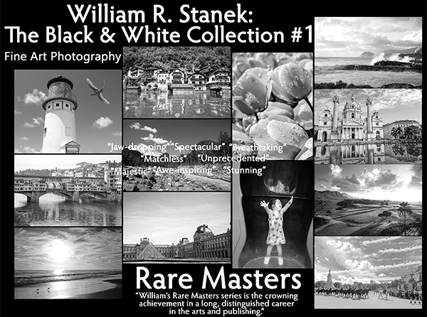
Step into a world of timeless beauty with our premium, oversized hardcover book - crafted for discerning collectors and anyone who values the power of art. Perfect for your coffee table, it's more than just a book; it's a conversation starter, a window into over 30 years of William's visionary photography.
Your Support Matters
Purchasing artwork from William Stanek's collection not only brings beauty into your life but also helps us continue to share. Thank you for supporting our creative journey!

Support The Lights of Paris by Robert Stanek, William Stanek's pen name! Through vivid historical detail and deeply moving character stories, Robert takes readers on an unforgettable journey through one of history’s most transformative times.
